Tuesday, December 31, 2019

Year's End Running Summary for 2019

Since this is my first time posting my year's end running summary on my blog, I want to go all the way back to the first year I tracked my running mileage, 2014. Mostly for my own information, I'll update a tidbit about each year before doing my summary for 2019.

2014 isn't the first year I was a runner (that was 1998), but it is the first year I kept dedicated track of my training.

I use Marty Jerome's logbook, which is specific for runners.


2014

In 2014, I ran 1861.4 miles total. I ran on 240 days out of the year. This averages out to 7.75 miles per run, and 35.8 miles per week.

In this year, I ran my very first full marathon, the American Discovery Trail Marathon, in 4:51:21. I ran many shorter races, including the PPRR Fall Series.

2015

In 2015, I ran 1875.9 miles total. I ran on 244 days out of the year. This averages out to 7.69 miles per run, and 36.07 miles per week.

In this year, I ran my first ever Pikes Peak Ascent in 4:51:57. I also ran my second marathon, the Denver Rock & Roll Marathon. I had a tough day and it took me 5:39:38.

2016

In 2016, I ran 2171.7 miles total. I ran on 245 days out of the year. This averages out to 8.86 miles per run, and 41.76 miles per week.

In this year, I attempted to run my first ultramarathon race at the Greenland Trail 50k. Instead, the weather was absolutely horrid (blowing snow and frostbitten winds). The race director made the call to shut the finish line several hours early, so I didn't get my first 50k finish, instead completing three loops for 37.5k. This was the first race I actually wrote a blog post about on this blog.

I made up for it with my main goal of the year, which was my first ever Pikes Peak Marathon. (And third marathon ever run.) I broke my Ascent record from 2015 during the Marathon, topping out in 4:24:35. My round-trip time was 7:25:53, a time I was satisfied with.

This was also the year that I ran my first ever ultradistance, although it wasn't in a race. I turned 30 and I ran 30 miles to celebrate, running from Greenland Open Space to Jack Quinn's (downtown.)

This was ALSO the year that Bailey and I ran to Cripple Creek from North Cheyenne CaƱon, a big adventure run that I'd been wanting to do for some time.


2017

In 2017, I ran 1749.9 miles total. I ran on 192 days out of the year. This averages out to 9.11 miles per run, and 33.65 miles per week.

This was the summer that I worked at the Garden of the Gods as a park safety (foot ranger). I walked a ton of mileage, which I didn't include in my training log, but amounted to a lot of additional ultramarathon training.

This year, I ran a number of important races, beginning with my fourth marathon at the Sedona Marathon in Sedona, AZ. This somewhat hilly course was a challenge for me, and I finished in 5:12:18.

In April, I ran the 24 Hours of Palmer Lake (Death Race.) I intended to make the full 24 hours, but I bailed after 17.5 hours, giving me a total of 65 loops around the lake and approximately 55 miles by my GPS. Although this was my first time running more than 50 miles, I still hesitate to "count" that distance, since it was completely pancake flat.

Then, in June, I ran my fifth marathon at the Leadville Trail Marathon. This interesting course climbs around Ball Mountain before ascending Mosquito Pass and returning the same way. This was more on par with the Pikes Peak Marathon for elevation gain. I finished in 7:01:08.

My final goal race of the year was the Grand Traverse, a 40 mile point-to-point race from Crested Butte to Aspen which ascends two major mountain passes (Star Pass and Taylor Pass). I had one of the most enjoyable experiences of my life, even though I was only 5 minutes in front of the tightest cut off. I finished successfully, in 11:51:26. (This is a race I never wrote a blog about, but I hope to review in a future post.)


2018

In 2018, I ran 1127.6 miles total. I ran on 109 days out of the year. This averages out to 10.34 miles per run, and 21.68 miles per week.

To start the year off, I ran an adventure run with Bailey, this time from Balanced Rock to Woodland Park.

I got more into weightlifting this year, and ran fewer times on average. When I did run, I preferred to run longer, since my runs were less frequent.

This year, I signed up for the Human Potential Running Series membership, so all of my races were a part of this series. My first race in the series was the 6-Hour Stories Ultra, which was hosted locally in Cheyenne Mountain State Park. I ran 20.2 miles in very muddy conditions.

The second race I ran in the series was the Tommy Knocker 12-Hour Ultra. This was hosted in White Ranch Open Space near Golden. The weather at this race was mystical and foggy, and once again there was a lot of mud along some portions of the course. The race is challenging with plenty of altitude change. I rounded out 33.24 miles. Here is the blog post about that race, with photos.

The third race I entered was the Last Call 50 Miler. This was a crazy midnight-start 50 mile mountain ultra, and I snapped my ankle really badly at mile 14, but walked for another 19 miles until mile 33 where I dropped the race. My first DNF, and the injury still bothers me to this day. Here is the blog I wrote about that experience. Despite the injury and continuing treatment of that, I am thick-headed enough to still be a runner. Go figure. :)

2019


In 2019, I ran 934.0 miles total. I ran on 103 days out of the year. This averages out to 9.07 miles per run, and 17.96 miles per week.
This year, I decided to make one race goal and stick to it. I didn't even run any other races. I went all in for the Pikes Peak Ascent. Unfortunately I had a bad muscle cramp in the race and didn't make my goal time, but I still bested my previous Ascent time, finishing in 4:24:04.

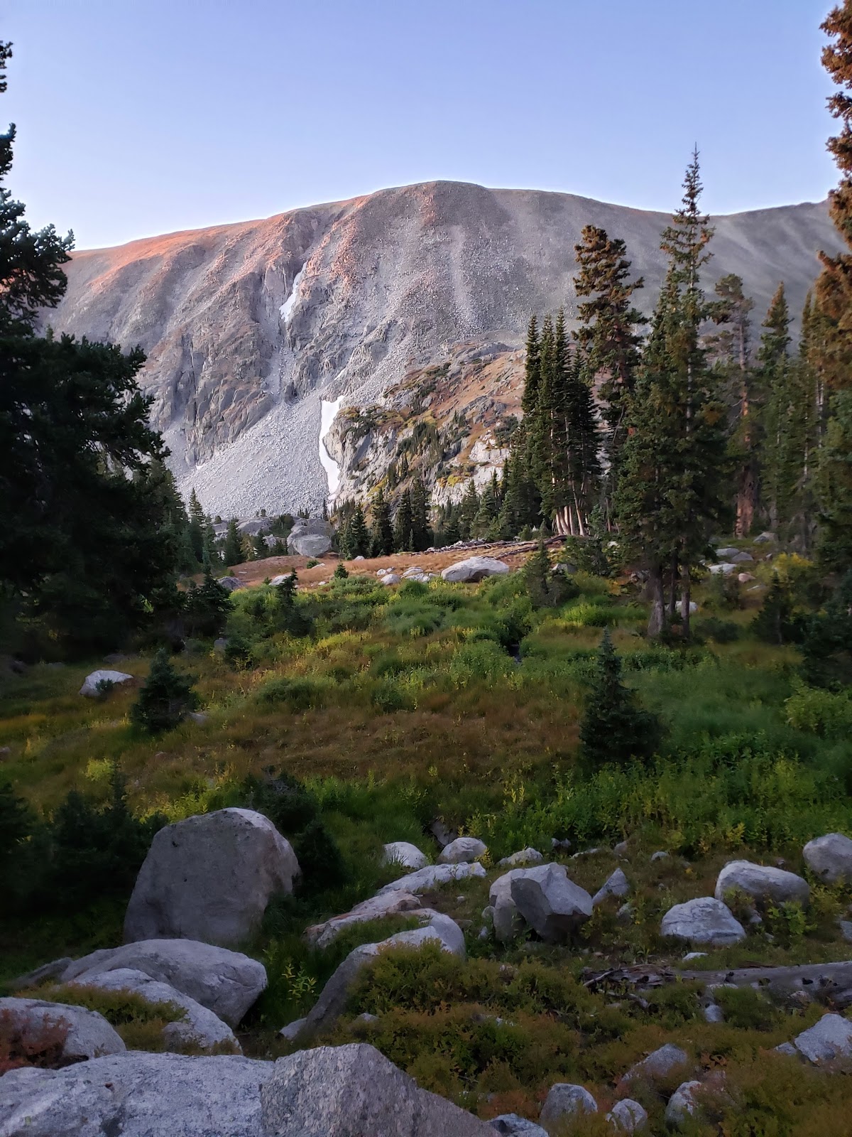
I was hoping to get at least 1000 miles this year, but narrowly missed that goal because I had to take a mandatory 4 weeks of from running after my surgery. Nonetheless, it was a great year for adventure runs! I did a big loop with Jim in Lost Creek Wilderness; and Pawnee-Buchanan loop with Dionne in the Indian Peaks. I tagged 14ers with Dionne and with Lindsay. I saw a lot of new wilderness areas in Colorado, and I finally ascended Pikes Peak via the south slopes. Sharon and I trained all summer for the Ascent with plenty of altitude gain, including one run that "accidently" became more of an adventure when the summit house was closed. It's been such an interesting and fruitful year, and I thank everyone who was a part of my adventures this season.

Looking Forward to 2020

For 2020, I've already modified my goals slightly. My husband gifted me race entry to the Golden Gate Dirty 30! I'm excited and looking forward to this race, which includes over 7,000 feet elevation gain over the 50k course. Since this race is May 30th, I'll still have time in the autumn to do some great adventuring. The Four Pass Loop is still on my bucket list, as is going to the Grand Canyon. I would also like to consider being a pacer for 20-30 miles at the Leadville 100. There's so much to do, so many goals to complete! For now, I'm thankful that I'm feeling better and nearly ready to hit the trails again.

Sunday, November 24, 2019

Last Incline of the year with Sharon + Monument run

On Monday, Sharon and I did an Incline, which will most probably be my last time in the mountains for 2019. The moon was setting behind the Incline as we ascended.


I did not push overly hard, but kept going steady. It was nice to see Steve. It wouldn't be an Incline day without seeing him! :)

I was happy that I finished in a solid 37:26, with Sharon less than a minute behind me! Especially considering I was not going overly hard.


On Wednesday, I ran my standard 6 mile loop at Palmer Park, as clouds gathered and enveloped Pikes Peak.


Finally, today (Sunday) I ran my long run, totalling just under 21 miles, ending at Serrano's Coffee in Monument. I figured I'd make the best of it, since I will be undergoing surgery on Wednesday, and I won't be running for at least 4 to 8 weeks.

Luckily for me, the weather was perfect today.


Afterwards, my husband brought the kids for some playtime at the park in Monument and my ride back home. :)


After surgery, I'll be going back into running slowly. Although I hope to keep my goal races for next year on the calendar, nothing will be set in stone (or registered for!) until after I gauge how my recovery is proceeding.

Have a happy holiday season, everyone! I'll likely update near the end of the year with my recovery progress and year-end summary.

Wednesday, November 13, 2019

Goals of the decade, revisited for 2020.

My last few weeks have been rather uneventful on the running front - I am keeping to local urban trails, Pikes Peak Greenway, and Palmer Park loops. Falling back into a winter routine made me feel like it was the perfect time to look forward to next summer season, and begin dreaming and planning.

About a year and a half ago, I made this post about several major goals that I had for the next decade or so.

For 2019, I picked to do the Pikes Peak Ascent. My goal was less than 4 hours, I had a tough day and came in at 4:24. Here is the link for the race recap post I made.

Despite not quite getting to my goal on that one, I've decided to move on and pick a new goal for next year. I don't prefer to run the same race two years in a row. (Variety is the spice of life, isn't it?)

Looking back at the top goals I had listed, I am not sure I'll ever do a 100 miler. That goal is on hold, pending me successfully completing a 50 miler. With that in mind, my main goal of next year will most likely be the Silver Rush 50 miler in Leadville.

I think the race will be a good way to test my mettle and see if I have the physical and mental capability to go even further in Leadville. (The Leadville 100 being the pinnacle trail race goal for many ultra runners.) I'm giving myself a 50/50 chance of ever doing a 100 mile race. Just saying. It's such an ultimate goal to have, but 50 is tough enough!

The Silver Rush 50 is in the second weekend of July this coming year. The race has a 14 hour cut off. My goal will be to do the race in just 12 hours, but I'll be happy with simply being able to finish under the cut off if it comes to that!

In light of this primary goal, in the spring I will probably plan on doing the Palmer Lake Death Race aka 24 Hour Race (again). I did this one in 2017 for the first time and had a blast. I did end up quitting after about 17 hours, which amounted to about 55 miles.

My goal at the Palmer Lake Death Race will simply be to keep moving and pull through the whole 24 hours. I will keep track of distance, but I won't necessarily have a distance goal for this one.

Another priority for me for next year is the Four Pass Loop. If you're unfamiliar, this is a 28 mile loop near Aspen which is a trail running classic. This will likely be one I do after the Silver Rush 50. Ideally, this will be my big autumn color run, much how this year's Pawnee-Buchanan Loop was.

My primary training will have to include a lot of runs that are high altitude, but fairly flat and long. The Almagre summit road (FS 379A) comes to mind as a good example. But of course, I won't be neglecting my Barr trail runs. I'll do all kinds of other fun stuff in the Pikes Peak region once the snow melts out again, and I'll probably try to target at least a few 14ers when they're accessible.

For now, I'm hoping to get back on the Incline with Sharon and Jill this coming week, and keep at least a minimal amount of altitude training under my belt during the off season.

Monday, October 28, 2019

Williams Canyon to Waldo Canyon to Longs Ranch Road with Dionne

I've neglected to update about my last long run with Dionne, which was over a week ago. I did want to post at least a short update with a few photos, because this run was so interesting to do.

The last time I ran the Waldo Canyon trail -the whole loop - was many years ago, during my cross country team days. This was way before the Waldo Canyon fire of 2012, which forced the closure of the trailhead off of highway 24, which remains barricaded to this day.

However, in the recent years, runners have returned to Waldo Canyon, finding the overgrown trail and running this excellent loop.

This was my first time ever exploring in Williams Canyon, which snakes up past the Cave of the Winds to connect with Waldo Canyon trail.


We first scrambled up to one of the caves in the Williams Canyon area, before continuing up to the top to check out the view.


Then we scrambled back down the steep gully and continued on the trail until it connected with Waldo Canyon.

The Waldo Canyon trail itself is somewhat overgrown from 7 years of no maintenance. But on this perfect autumn day, it didn't seem difficult to navigate the turns between the autumn foliage and yellow grasses. We even got some cool action photos!


We then crossed over highway 24 and went up Longs Ranch Road, where we found the last remaining yellow aspens that hadn't lost their leaves in the recent freeze.


What a fun time exploring in our local area!

Since the run, it's been snowing off and on in Colorado Springs, and every run I've done since then has been something I can access from my doorstep. Without boring you with mundane details, I'll simply post a few photos with captions.

A rock outcropping along Templeton trail at Palmer Park. 

A famous view of Pikes Peak with a prominent rock formation from the northwestern corner of the Templeton trail loop.

Julie Penrose fountain at America the Beautiful Park, with clouds closing in over the mountains. 

Yesterday's long run was the Legacy Loop from my house, totaling a bit more than 12 miles. I then watched as the clouds slowly moved towards town, enveloping the city in snow as evening set.

Yes, it feels as though winter has already arrived in Colorado. It is time for me to back off on the mountain running, and stick to the local trails. More consistent flat mileage is in my immediate future, not to mention more time in the gym. It's also a good time to dream of the coming year and make plans for adventures to come... more on that in a future update!

Tuesday, October 15, 2019

One more time on the Peak! October Elk Park with Sharon

Last year in October, Sharon and I did a summit of Pikes Peak on October 21st. There was minimal snow last year at this time, but we started at 6am and it was still quite dark.

This year, we went one weekend earlier in October, which was the 13th, and we did Elk Park instead of the top. We also started at 7am instead! It was more comfortable to be starting with the sun, and knowing we wouldn't have to make the full summit, especially since the snowstorm. (Although we saw several groups setting out for the summit along the way).

Even at 7am, it was quite cold until the direct sunlight began to warm up Engelmann Canyon.

Most of the aspen leaves, which were so beautiful over the last few weeks, had fallen off since the hard freeze with the snowstorm. But almost all of the snow on Barr up until Camp had melted off, and the groundcover in the forest was still exceptionally green from the wet spring and summer we had.

The thick mossy carpet at the base of this aspen.

It was nice to stop in at Barr Camp and see Zach. He had no news for us as far as Elk Park trail conditions, but he'd seen several cyclists coming from that way and assumed the conditions were pretty good.

Just a dusting of snow in front of the cabin at Barr Camp.

They were pretty good, as we discovered. There were a few patches that don't see much sunlight that had some snow buildup already, but the snow was soft powder that wasn't too slippery. We also saw several more cyclists coming downhill.

Sharon in the meadow on Elk Park trail. 

The places where there was a bit of powder. Not full winter conditions yet!

Even though we were just a bit too late for the aspens, the views of the mountain from Elk Park trail are always set to impress!

I'd really like to come back here and do some of these harder-looking scrambles on the ridgelines approaching the northeast side of the Pikes summit.

The meadow before the Oil Creek Tunnel split.

The sign says "Oil Creek Tunnel .5 (to the right); Barr Trail 4.5 (to the left)"

The last steep climb after the Oil Creek Tunnel split leads to treeline.

Soon we reached the treeline where all of my really favorite views appear! As most people who have run with me before know, I like to spot different mountains and become as geographically knowledgeable about the area as I can be. This helps me in several practical ways. First, as I become more familiar with each mountain and valley, it keeps me oriented correctly, and less likely to get lost on adventure runs. Second, my ability to translate map-to-nature improves, and navigation in new places becomes more quick and intuitive. 

Can you spot the cyclist that just passed us, headed down around the bend? 

The view northeast from the Elk Park trail. Severy Creek is below flowing through the meadow, with an unnamed knoll to the right in the foreground. Ormes and Blodgett Peaks make their appearance in the central background. 

The view north from Elk Park. You can see so many 14ers from here! Not sure if the quality of compression will allow you to see much, but in this photo, Bierstadt and Evans are to the far right in the background.

We did it! Myself and Sharon at the top of Elk Park trail. 

Finally we topped out on Elk Park on this beautiful day. Another refreshing day in the mountains completed!

Wednesday, October 9, 2019

A trio of local 9000-foot summits: Kineo Mountain, Grouse Mountain, and Blodgett Peak

No, not all in the same day! That would have made it more challenging. My runs lately have been local and short for the most part.

Last Saturday, I did Kineo Mountain, starting on Seven Bridges trail (622). In order to make it a bit more interesting than the usual route, I cut off early and scrambled directly up the south face of the mountain. This wasn't a tough scramble, although it was steep. It was mostly deep scree and a few bands of easy-to-climb boulders. I arrived right at the saddle below the summit and quickly topped out. I returned to North Cheyenne CaƱon via trail 667, connecting to 776.

The saddle below the summit of Kineo.

The rock outcroppings atop Kineo are super neat!

Summit panorama, Kineo Mountain.

The view of the North Cheyenne Creek drainage, with the south summit of Almagre in the distance to the right side of the photo (it's the one above treeline.)

Then on Sunday, we took the kids for the Kids Fall Series 1 race at Bear Creek Park. The Fall Series, put on by the Pikes Peak Road Runners, is a free "fun run" race series for children that fosters a love of running.

After that, we headed up to Mueller State Park to catch some fall colors. We decided to do the Grouse Mountain trail. This short trail is only half a mile to the summit! It was so short, even for the kids, that we added some additional hiking after that. This summit was so easy that it's almost cheating!

The kids and the summit sign.

The view south from Grouse Mountain. Mt. Pisgah is the pointy one just right of center, and the Crestones are the range far in the background on the right side.

Alex and I at Mueller State Park. 

Finally, today (Wednesday), I decided to do a quick midweek trip up Blodgett Peak. This would mean I'd topped out three local 9000+ foot peaks this week (although one was almost too easy to count.)

Blodgett Peak is an interesting mountain. If you are adamant about sticking to the primary drainage, it can be a class 2 all the way to the summit. If you deviate from this  at all (intentionally or not), it can quickly become a class 3 on the boulderfield or even a class 4 or 5 where the cliffs are.

Today, I intentionally sought out the boulderfield, and scrambled up through the main "crack" between the two cliff faces below the false summit. I then traversed the ridge to the true summit.

The main crack between the two cliff faces has a couple tricky moves which I would consider class 4, and one spot where it was so washed out that I had to climb up the side of the cliff a short way. I'm not an expert but this single move seemed to be class 5. It might have been avoidable if I was taller or the gully was less washed out, but as it stood from where I was, it looked like the safest route.

Climbing between two cliff faces.

The narrow view down. This route could be dangerous!

When I topped out on Blodgett, I sat and soaked in the views with my binoculars. I watched cars driving the dam at Rampart Reservoir. I had a clear view of the 14ers Bierstadt and Evans, and I could even (faintly) make out Longs Peak far in the distance.

The views on top Blodgett Peak are very worthwhile! For such a short summit, less than 10,000 feet, there's a LOT you can see from up there. I could have stayed up there all day. Blodgett definitely is the best mix of challenging climbing, local accessibility, and superior views for a fairly small time investment.

The true summit of Blodgett as seen from the false summit.

Pikes Peak behind the golden foothills. These trees were all burned in the Waldo Canyon fire in 2012, creating an interesting contrast with the autumn-colored shrubs.

Blodgett Peak summit panorama. 

Selfie! What a hot day, considering we're expecting snow tomorrow.

What a super week in local adventuring. Now I can sit home and comfortably await our first snowstorm of the season tomorrow. However, I think I'll still be chasing summits this season as long as the weather permits.

Wednesday, October 2, 2019

Journey through the heart of the Indian Peaks: Pawnee-Buchanan loop with Dionne

After last week's Mt. Herman loop with Sharon, I knew the aspens would be changing colors, as well as the autumn weather ushering in the snow soon. With that in mind, I convinced Dionne to go to the Colorado high country with me before it got too cold and late in the season. We decided to do the Pawnee-Buchanan loop in the Indian Peaks Wilderness. 

This popular running loop is around 27 miles and 7800 feet elevation gain. 

We set out on Sunday the 29th very early, arriving at the trailhead with the stars still filling the sky.

During our drive up, we passed through a lot of fog in Boulder. Our drive took us up through Left Hand Canyon. By the time we reached the Brainard Lake area, the fog had completely cleared and the night sky was gorgeous.

"Is it snowing?" Dionne asked as we first set out from the Long Lake trailhead. Yes, it was just barely snowing! Likely just some remaining condensation from the fog that was mostly below us now.

Unfortunately we went slightly wrong at the very start by the first lake, so we'd already added half a mile to our day before we began. No big deal overall. 

On our second pass by the lake (in the correct direction), the early astronomical twilight was reflecting off the water. A clear and beautiful indication of the day about to start!

Soon we were at the first trail junction, with Navajo, Apache, and Shoshone Peaks in front of us. These jagged 13ers dominated the skyline during our first climb, towards Pawnee Pass.


The robust-looking Mt. Audubon with the last moments of pink-tinged alpenglow stood in front of us as we climbed.


Soon the sun was high enough above the horizon to color this rock wall bright orange with its morning light.


Looking back towards the east, we could see the fog that we drove through in the morning in Boulder and just outside of Boulder in Left Hand Canyon. Wow, it was cool to see the sea of clouds so far below!


It wasn't long before we were above treeline, in alpine tundra, and near the top of Pawnee Pass.


And then, there we were! The top of the Continental Divide, and the first and tallest climb of our day. It was cool to still see the clouds way down below.


The wind at the top of the pass wasn't that terrible, but once we started descending the pass to the west... wow, we entered the wind tunnel!

The winds were extreme. At one point I almost got blown down by it. Nonetheless, I could not take my eyes off the gorgeous views. That clear blue lake off in the distance is Lake Granby!


After this point, the trail descends steeply into a sharp canyon, surrounded by jagged rock formations. The landscape is barren and dramatic. I told Dionne later that I felt like I was on a grand quest towards Mordor!


Look closely! You can see Dionne on the "trail" - more like a scree gully with overhanging rocks above.


The wind was still brutal this whole way. Furthermore, we descended into the shadows, making the transition from the daylight at the top even more drastic.

We continued to descend toward Pawnee Lake.


And then we passed the lake, and continued descending even more. In fact, we descended so much that I started to get worried! It was a lot of downhill.

From the bottom of the valley, the classic picture of Lone Eagle Peak came into view. (It's the pointy one.)


And from here on, the fall colors got better and better. I was exhilarated by the beauty of it all.


We passed by several pretty waterfalls.


And finally, it was time to start climbing again on the way to Buchanan Pass!


We achieved treeline fairly easily, and the wind atop Buchanan Pass was significantly less than the wind atop Pawnee Pass earlier in the day.


Descending from Buchanan Pass to the east, the ground was covered in beautiful red foliage! The sharp autumn sun above treeline made everything so much more bright and bold.


Soon we'd descended to the Coney Flats area, and we were ready for our third and final climb, back up towards Brainard Lake.

The last climb of the day was deceptively long, as it isn't a named pass, but still reaches treeline one more time before the descent into the Brainard Lake Recreation Area where we'd started.

On this last climb, Dionne was pretty beat and ready to be done. I think the EnduraLite that she had shared with me was working, because I still felt like I was in decent shape for being well over 20 miles into this venture.

The view to the north from this part of the trail was a massive panorama of the south face of Longs Peak and the high points of Rocky Mountain National Park.


I think it's so cool that from this loop, we were able to see both the east and the west sides of RMNP, which is a huge National Park!

Finally, as the sun was beginning to go down and the shadows became longer again, we returned to Brainard Lake.


It took us almost exactly 12 hours to do the whole loop; 6am to 6pm. Wow - what a long, tough day! We certainly weren't setting any speed records, but it doesn't matter - the experience alone was completely worthwhile.

We drove home through Coal Creek Canyon instead of the way we came (through Left Hand Canyon), so even the drive itself was somewhat of a nature loop, too.

This amazing journey covered so much territory, and such a variety of sights! From the windswept heights of the Continental Divide, the cragged and exposed descent from Pawnee Pass, to the rich Aspen-filled valley below, and back up to the red-tinted meadows beyond Buchanan Pass - it was like packing a whole lot of life into a single day.

Thanks again to Dionne for going with me on such an adventure! And special thanks to my husband Alex for holding down the fort at home while I let my soul wander through nature. The Indian Peaks are a special place, a spiritual place, and a place where one can find a kind of lasting contentment that permeates forward into the coming days and weeks.