Sunday, April 28, 2019

St. Peter's Dome from North Cheyenne Cañon (with route description) plus sunset run at Palmer Park

Hello friends in the blogosphere (what a weird word)!

It's been a week since my last update, and it has been a week full of hills - in the literal sense.

On Tuesday, I set out late in the day for a sunset run at Palmer Park. It was an amazing evening. The sun's rays split through the clouds as I ascended the northern mesa on the Templeton trail.


I ran the Yucca Flats loop and then crossed the road, running along the Grandview trail on the southern mesa until the overlook. This double-loop of Palmer Park is one of my favorites for a mid-length trail run that begins right from my doorstep. It's great to live here in central Colorado Springs, with such a great urban trail network and a beautiful in-town park like Palmer Park.


I returned home just after dark, and immediately hit the weights for some overhead barbell presses and side lateral dumbbell raises. Our home gym isn't huge,  but we have the basic staples we need: dumbbells, a barbell with adjustable weights, and a captain's chair with pullup bar in the yard.

On Thursday, I had planned to go to the Incline club speedwork, but I wimped out due to the weather. It looked terrible over the mountains about half an hour before the run was due to start. Of course, it looked clear by the time the run started, but I'd already opted out.

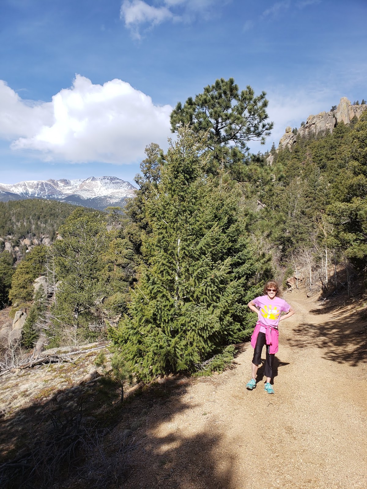
Instead, I delayed my run until Friday and went back to Palmer Park instead.

This time I did a backwards loop of the northern mesa, and left it at that. Speedwork it wasn't, but hills, yes. I went a bit earlier and I didn't catch the sunset this time, but I did get a photo of some wildflowers blooming in the park.


And, finally, the run you've all been waiting to hear about: my Sunday long run to St. Peter's Dome.

This is a run I did last year with Mary, Steve, and Jim, although I didn't blog about it. I also did this run with Lindsay the summer before last, although we didn't do the rope climb.

Since I'm now off Facebook, I am blogging more about my runs instead of just posting photos to social media. In a way, posting photos to Facebook doesn't tell the whole story, anyway, and I wish I'd blogged more about other runs I've done in the past.

Blogging certainly allows me to share more detailed route descriptions!

I set off on today's run from the dirt parking lot at the top of North Cheyenne Cañon. This is such a good launch point for adventures. Initially today, I wasn't sure if I'd do the Dome run, or push a Mt. Rosa attempt. But it was a bit windy at the start of the day, and I reasoned that there was still probably snowfields on Mt. Rosa - so I decided on the Dome.

This route begins with a long haul along the closed section of Gold Camp road.

If you're attempting this route, it is most important to go to the left at the St. Mary's Falls trail split, and cross the creek.


If you fail to go left and across the creek here, you'll be going in the wrong direction for St. Peter's Dome!

After crossing the creek and coming around the next cut, you'll get your first glimpse of the Dome. It looks so far away!


In this photo, the Dome is the leftmost rock outcropping along the ridge.

As you continue running along the road (no vehicle traffic - only the occasional cyclist and hiker), you'll come around the side of Stove (Cookstove) Mountain.


The Dome gets nearer!


You'll go through two tunnels before turning off of Gold Camp Road. On the map, these tunnels are labelled as Tunnel #4 and Tunnel #5, but for you they are one and two. The reason Google labels them as such is because tunnels #1 and #2 are on the portion of Gold Camp that is still open to vehicle traffic, and tunnel #3 is collapsed (which is the reason this whole section is now non-motorized).

Here's a view through the first tunnel you go through (Tunnel #4).


After the second tunnel, you'll be approximately 6 miles into your run, and you'll see a big sand wash ahead of you. This is your turn off. It's steep, but it doesn't take very long. I have yet to find a better way to approach this trail.


If you turn around, you'll see St. Peter's Dome immediately behind you. This is how you know you're in the right spot.


Stay to the right side of the sand wash, near the trees. The dirt bike tracks will curve to the left, and at the top of the wash, you'll abruptly encounter a solid trail. You're set now - this trail will take you all the way to Old Stage road.


At Old Stage road, you'll come to the official trailhead for St. Peter's Dome. You could drive all the way up Old Stage to the trailhead (many people do), so you'll likely encounter some other hikers here. But the point of this run is to tackle the summit from North Cheyenne Cañon (a much shorter drive).

The official trail is only seven tenths of a mile, and it'll bring you to the rock outcropping with the fixed rope. Oh - did I mention? There's a rope climb (class 3+), and it's a little bit risky, so don't do this unless you're prepared to be a little adventurous!

The rope looks like this:


Because it's an overhang, you have to trust the rope. It's a little anxiety-inducing for those of us who aren't experienced rock climbers.

Beyond the fixed rope, there's another section that's a little iffy. It's another steep segment on a slick rock with gravel on top. This segment used to have a second fixed rope, last time when I did this summit with Steve, Mary and Jim. That second fixed rope is now gone, which makes it a little tougher.


Yeah, the dropoff there is the trail. Not for the faint of heart. But after this segment, you're almost done. Just a little scramble more and you're atop the massive rock outcropping. Astounding views surround you! Mount Rosa dominates the view to the west.


You can see the whole city of Colorado Springs to the east. I can just about see my house from here (or at least spot the general area).


To the south, you can see a part of Old Stage Road, although another prominent outcropping stands in the way of most of the view. 


And here's proof that I made it up there!


Although it was very sunny on top of the Dome, it was SUPER windy. So I did not stay very long. I had a snack and made my way down, safely propelling myself back off the rock and trusting the fixed rope on the way down.

I'm glad that I left quickly, because not 5 minutes after I descended from the top of the Dome, the weather changed.


Soon it was spitting little styrofoam looking snowballs at me, in true Colorado style.

But, again in Colorado style, the snow didn't last long, and it got really hot again as I jogged back. I netted almost 16 miles for the day and a great summit view.

I hope my route description can be of some benefit to someone looking to bag this summit without the long drive up Old Stage road, or just wanting to get a unique summit in combination with a nice long run.

Tuesday, April 23, 2019

Lake Moraine Trail (Missing Link Trail) early season attempt

My run last Saturday did not go as planned.

Sitting in town, heating up at 70 degrees, and looking at the foothills can easily lead to the conclusion that the snow is mostly melted below treeline.

But somehow that's not the case at all.

My day began at North Cheyenne Cañon after Alex dropped me off.


I coasted up Seven Bridges for a while.


It was here that I ran into a friend I haven't seen in some time and spent a few minutes catching up. Once again, running in the mountains without seeing someone I know? Impossible. :)

The trails were clear. Clear I tell ya! At the junction of trails 667 and 668, there wasn't even a patch of snow.


I continued up 667 at a reasonable pace. I stopped briefly to admire the view of Bear Creek Canyon at my favorite clearing in the trail.


If you look in the middle of the photo, you can almost see the clearing near the patch of bare aspens below the central rocky summit. That's Jones Park, complete with the large rock and decommissioned trail. Yep, just a couple years ago the trail 666 used to run through here, but it has since been "suspended" for use for a minimum of 20 years while trout restoration is in progress.

Not far beyond the overlook, the problems began. The trail was absolutely clear - until it wasn't. About 9000 feet, the snow began. And it wasn't just any snow. It was snowfields that had been melted on top and refrozen, creating really tough, crunchy, icy snow...

Drifts in some areas were *still* several feet deep.


I kept post holing and crunching through nasty snow until the junction of 701 and 667.


Even though the whole trail is engulfed in snowdrifts by this point, I still didn't give up quite yet. But just past this intersection on trail 667, there was a part of the trail that was so eaten up by snow that I had to come to terms with the day.


That's the trail under there somewhere. And I knew that even if I made it around that bend, there would be another snowfield around the corner. And the post holing was time consuming, and there was basically no way I'd make it to Barr Camp today. My adventure would have to wait for another day.

I turned around and decided to head down 667 towards High Drive, knowing that I could add more mileage if I went down High Drive and towards Bear Creek Park. At least I could make a 15+ mile day out of my unsuccessful Barr Camp attempt.

I stopped for a minute to refuel in a clearing and take in the view of the Mt. Rosa saddle. The summit of Rosa itself is hidden behind the saddle.


Here's a view of Mt. Kineo poking through the trees. This is a favorite "short day" summit for me, as it is a quick 6 to 7 mile trip from Seven Bridges. Today, I skipped that summit and just headed down 667, wanting the mileage more than the views.


Next I wanted to share a neat view from coming down 667 just before the 776 junction. In this view, in the lower left corner you can make out the North Cheyenne Cañon dirt parking lot. In the upper right corner is the summit of St. Peter's Dome! I thought this was a super cool view of one of my favorite runs from last year. You can see the way Gold Camp Road (the non-motorized section) winds up towards the Dome. Beyond the Dome, Gold Camp comes to a junction with Old Stage Road (seen on the back side of Cheyenne Mountain in this photo). What a cool view!


Finally, a photo of the classic view from Mt. Buckhorn. A favorite view featuring the summits of St. Peter's Dome, Stove Mountain, Mt. Rosa, and a little bit of the road (FS 379A) below the Almagre summit.


The Buckhorn summit is just a bonus along the already gorgeous trail 667. After this, I was pretty tired, but I descended High Drive to the north and jogged along the road to the Bear Creek Nature Center, where I met Alex. A total of almost 16 miles, I'd gotten my fill of expansive views and fun trail running, despite my unsuccessful efforts to make a connection to Barr Camp. 

The Lake Moraine trail will have to wait until the mountains melt off more. This is still a trail run that's on my list! But I certainly underestimated the snow levels in the foothills. 

Thursday, April 18, 2019

Weekly Training Update- Summer is almost here!

I was going to call this post the "Wednesday Weekly Update," but I neglected to post yesterday and now it's Thursday.

Let's start with last Sunday- my usual long run day. It snowed quite a bit in the mountains on Saturday, so I knew it would likely be a post holing slog on Sunday morning. Instead, I opted for the run-to-Monument thing that I do as an alternative to a mountain run.

Starting out, as I headed down the hill towards the Templeton Gap Trail, it was apparent how much snow was on the mountains. You can even make out the little snowy line of an Incline. Still, the forecast was over 60 degrees, so I knew the snow in town wouldn't last.


The Templeton Gap Trail feeds right into the Pikes Peak Greeway/ Santa Fe Trail, which is the continuous "spine" trail that I'd be on for the rest of my run.

I especially enjoy running on the Santa Fe Trail through the Air Force Academy. Although it's still relatively flat, it's somewhat different than any other urban trail, with sweeping meadows and views of the northern Pikes Peak region and the southern Rampart Range.


Near North Gate Blvd, I ran into Tim and Karen, who were doing a 10 mile on the AFA! I think it's impossible for me to do a long run and *not* see someone I know - which I feel says something. For a town of nearly half a million, the Colorado Springs running community is still pretty close-knit.

I arrived at Monument, and although my pace was definitely nothing to brag about, I had felt strong and steady throughout my run. I hope my strength will help make up for lack of outright speed. Afterall, the Ascent is largely a competition of strength, especially once you get above treeline and pace slows due to lack of oxygen.

I didn't get a photo with Alex, and I should have, because he was kind enough to pick me up *and* take me to dinner in Monument. It wouldn't be possible to do fun point-to-point adventures like this if my husband wasn't willing to help me with the transportation. My total distance was just over 19 miles.

Then, on Tuesday, I got to do a little exploring of one of the newly renovated trails with my family. The Chamberlain trail goes through Stratton Open Space and connects to the area called Strawberry Fields, which was part of the recent land exchange. The land area is actually owned by the Broadmoor, but the agreement includes an easement for the trail, and vast improvements have been made.

A few photos of my kids and husband enjoying the trail:


And then on Wednesday, I got to do another weekly Incline with Sharon! I had so much fun last summer training with Sharon in the mountains, and we are off to a great start this year as well.

My time this week was 33:45!


That's only about a minute off from my PR. And I am sure that I'll be able to tackle it again in a time like that, so it's a good sign for my Ascent training this year. Reeling in that sub-4:00:00.

Again, we went up towards the No Name Creek junction before descending Barr Trail. Here's Sharon at my favorite overlook point.


And finally, today being Thursday, I decided to do a little weightlifting and swimming. Some declined bench presses, weighted lunges, and one-armed planks set me up for a nice relaxing swim. I will admit that I *considered* going to the speedwork session tonight instead, but really, it's so much easier to go the gym. As much as I love the Incline club speedwork sessions, it's harder for me to fit them into my schedule, as mornings are more open for me than evenings. Maybe next week!

I am very excited for this Saturday, as I have planned to do a special adventure for my long run: the "Missing Link" trail. Now officially opened and renamed the "Lake Moraine" trail, this trail connects North Cheyenne Cañon to the Mountain View trail, essentially creating a continuous trail in our mountains from the summit of Pikes Peak to the base of North Cheyenne Cañon. I'll only be doing the section from the top of the Cañon to Barr Camp, and then down Barr trail, but this is a run that I've been looking forward to for quite some time. I'll be sure to post plenty of photos after this run is complete.

A couple years ago, actually on another one of my run-to-Monument days, I stopped in to Criterium Bikes and bought a "Ride the Missing Link Trail" t-shirt in support of trail funding efforts, so I'm glad this trail has been completed and I look forward to seeing the results firsthand.

Wednesday, April 10, 2019

Weekly training update

I've gotten a nice amount of training (for me) in the last week. The next Colorado storm is coming in, already floating above the mountains. More on that in a bit.

I've been trying to increase my running frequency lately. Last Thursday, I headed out for a run, but I wasn't certain on a distance or destination. I considered going to Memorial Park again for another circuit day, but I decided that I wanted a more straightforward long run, so I did my usual 15 mile loop on Rock Island/ Pikes Peak Greenway/ Foothills Trail/ Sinton Trail/ Templeton Gap Trail.

Despite this loop being a staple for me a couple years ago, I actually haven't run 15 miles in distance in a couple months. The day was hot and the distance was taxing! The miles from 11 to 15 dragged on forever, and my pace plummeted. My ankle feels much better overall since the injury last year, but I need to get my distance endurance back up. Taking it easy, while good for my tendons, hasn't been as good for my cardiovascular and distance capabilities.

The view from the Garden of the Gods overlook point was a grand highlight of this urban loop.


It's been a while since I've run two long runs in a week, but Sunday was such a great day that I looked forward to hitting Barr Trail again.

I started off with a 38:36 Incline.


At the top of the Incline, it was so great to chat for a while with Mark! It was very refreshing to have some great conversation with an Incline clubber who I haven't gotten to know very well yet. Mark is an energetic guy and he is in for the Double this year - yikes! We chatted for a while about 3-2-1s and other training strategies that I look forward to utilizing this summer.

The Barr trail still has patches of ice and snow on the way up, and since I got a little bit of a late start, I decided to stop about a mile short of Barr Camp this week. I imagine running 15 miles on Thursday also slowed me down a bit. However, I was totally at peace with this decision for this week, and I pulled off Barr trail to take a few photos at a large flat rock outcropping before turning around.


Although the photos don't show it, someone has created a fire ring for a campsite at this rock outcropping. I'm always seeking little peaceful spots with amazing views of my favorite mountain, Pikes Peak. Barr trail has many secret places like this one!

So that was Sunday.

Today (Wednesday), I headed to the Incline for a second time this week, to meet up with Sharon. It was great to see her, since we haven't run together since last year. It doesn't seem like it's been that long. But time flies, and spring training is here!

Today's Incline was a 36:28.


I'm happy that my Incline times have been very consistent lately, mainly between 36 to 38 minutes. Although I'd like to gradually get faster (who wouldn't?), I think that consistent times show that I have steady strength on a challenging, steep trail like the Incline. I'd rather be in the 36 to 38 minute range regularly, than be in the low 30s one week and over 40 minutes the next.

After the Incline, the fun part of the workout was going down Barr trail at a conversational pace. Sharon and I stopped to snap a photo at the lookout point behind the Incline.


As you can see, the mountains are clear and the sun is shining. But as I'm writing this, the clouds are coming in and it's raining. Another serious snowstorm is forecasted for this evening. What a nice way to wrap up the last week of training during a good weather window.

It just goes to show that in the springtime in the mountains, you have to take advantage of good weather when you can! Hopefully this storm won't last long, and I'll be back in the mountains again this coming weekend.