Sunday, October 31, 2021

Week of October 25th, 2021 through October 31st, 2021

Well, let's get right to it.

***

On Monday, October 25th, I decided to try my re-introduction to speedwork.

I thought of a hill that was close to me that I figured might work, and jogged to it for my warmup.

A little more than 2 miles of warmup, and I measured the hill at about 0.08 miles, or a little longer than 100 meters (which would be 0.062 miles, which makes sense.)

I ended up doing 8 sprints up the hill, and going down slowly between.

The hill in question.

Overall, I was a little disappointed with my workout. 

Here's what I would change:

* The distance I picked was a little too long. I would have been better off with a slightly shorter hill, as I could really feel it after about 100m, that the hill was dragging on too long. Next time, if I go to the same hill, I won't start as far down it.

* I had a hard time feeling like I was getting my heart rate up enough. At the same time, I felt like I couldn't get my leg turnover to go fast enough. Possibly, my legs were not rested enough to do speed work today. Next time, I'll make sure to do my speedwork after a rest day.

* I delayed my workout a bit too long and left too close to sunset. My last couple hill sprints, it was almost dark. This slowed me down more than I'd like, as I needed to focus on not tripping in addition to going fast. Next time, I'll go earlier in the day.

For the three reasons above, my workout was less effective than I'd like. But at least I got out there and attempted some speedwork, as a way to get me mentally accustomed to running at a high effort level over a short distance. I added a little mileage on my way home, rounding the total distance out to 8 miles for the day. I'll try another speedwork session next week.

***

On Wednesday, October 27th, I ran just under 14 miles on an in-town loop with 1200 feet elevation, at sunset.


***

On Friday, October 29th, we took the kids for a sunrise hike at Palmer Park, with nice views of the morning alpenglow on Pikes.


That evening I did a short in-town run, 8.5 miles with 800 feet.

I was even able to get my phone camera to take a clear enough photo of the stars that you can make out Orion's Belt.


***

On Saturday, October 30th, we took a family hike somewhere different and new! We went to South Valley Park at the southwest side of Denver. It was a beautiful day, very warm and sunny.


The views were amazing and the deer were friendly.

All in all, a lovely week in Colorado. No mountain run this week, but maybe next week. We are anticipating a midweek cool-down for the weather. I would also like to attempt another speed session, maybe going for the hill again OR heading to the track. But we will see! Have a good week!

Sunday, October 24, 2021

Finding the Tenney Crags social trail from the north

Just a brief update from me this week, with a few photos.

Saturday, October 16th was a short 6-mile recovery run for me after my 25-mile effort on Thursday. 800 feet elevation gain.

Sunday, October 17th, I went out and did 15 miles with 1500 feet elevation. I didn't actually plan on going this far, and I didn't bring my pack, or any water. It was a nice day and I just tallied up a little extra mileage.


Tuesday, October 19th, I did flat and easy, a little over 7 miles with only 500 feet elevation. 

On Thursday, October 21st, I set out from Red Rocks Canyon way too late in the day to do a full mountain trip, but I wanted to get some trail scouting in for future reference. 

I started out on Codell trail and followed this all the way along the ridge until I joined Section 16/ Palmer Trail loop. It was a lovely and quiet evening on the trails. 


I took the trail split to the west off of the typical loop, and had neat views of the Crystal Park community, as I'd never been on this part of the trail before.

There were some cool rock formations along the trail.


Soon enough, I saw a social trail heading south along the ridgeline in the expected direction of Tenney Crags.


The trail was well-cairned on the section that I was on. However, it was quickly beginning to get dark since I'd started so late. I did not want to be lost in the dark, so I returned to the Section 16 trail. I decided to complete the loop, back down towards High Drive. It was fully dark for my last two miles, but I felt safe on this trail which I've run so many times before. It was actually quite beautiful with the moon rising.

I got a total of about 10.6 miles and 3600 feet elevation gain for the day. Still not a bad total for an adventure cut short! This is a trail that I have an immediate priority to return to, and complete. From some online research, I think I found the social trail on the north side of these mountains that connects from Tenney to Mt. Arthur and Mt. Garfield. This trio of summits may be next on my list!! But I will need more time (and more daylight) to do it.

To bring this back around to the current day, I did another shorter run on Saturday, October 23rd, gaining 8 miles and 1100 feet elevation.

The clouds were really cool this evening.


I also did a few days of weightlifting throughout the week, though I didn't include the details this time.

Generally speaking, this was a little bit of a lighter week, since I didn't do something in the 20+ mile range. 😆

There is an 's' word that I wanted to mention before I close this blog out. I've been avoiding that 's' word for the last... oh, two years, give or take. The secret word is "speedwork." 😂 The truth is, I haven't been putting in the real work, the HARD runs, the stuff that makes a runner faster. Yes, I have an endurance base beyond that of most casual runners, but I severely lack speed. I'm hoping that by mentioning it here, it will help me schedule some speedwork sessions and then actually carry through. I won't be able to reach my goals for myself without including some quality sessions. I think I'll start easy by doing hill repeats before moving on to flat track intervals.

Hopefully sometime next week I'll report back with success on both speedwork and maybe even completing the Tenney-Arthur-Garfield summit trio that currently tops my list. 🤞

Saturday, October 16, 2021

South Blodgett Peak Open Space to Rampart Range Road crossover

I'm feeling good lately, doing a little bit higher mileage than usual. The week of October 4th through October 10th, I ran 57 miles. It's been quite some time since I've done a 50+ mile week.

I typically alternate run days with gym days to allow a little recovery for my legs.

I also ended up doing another long one (25+ miles) on Thursday, just 8 days after my 24+ miler. I didn't really plan it that way, it just happened. 🙂 It was a fun adventure that I've had in mind to attempt for a while, but I'll get to that in a moment. 

***

Sunday, October 10th, 2021:

In-town run, 16 miles with 1300 ft elevation gain. Went up through Pulpit Rock on my way back. Sunny, warm day.


***

Monday, October 11th, 2021:

Standing machine pull-downs and machine chest press in my gym.

***

Tuesday, October 12th, 2021:

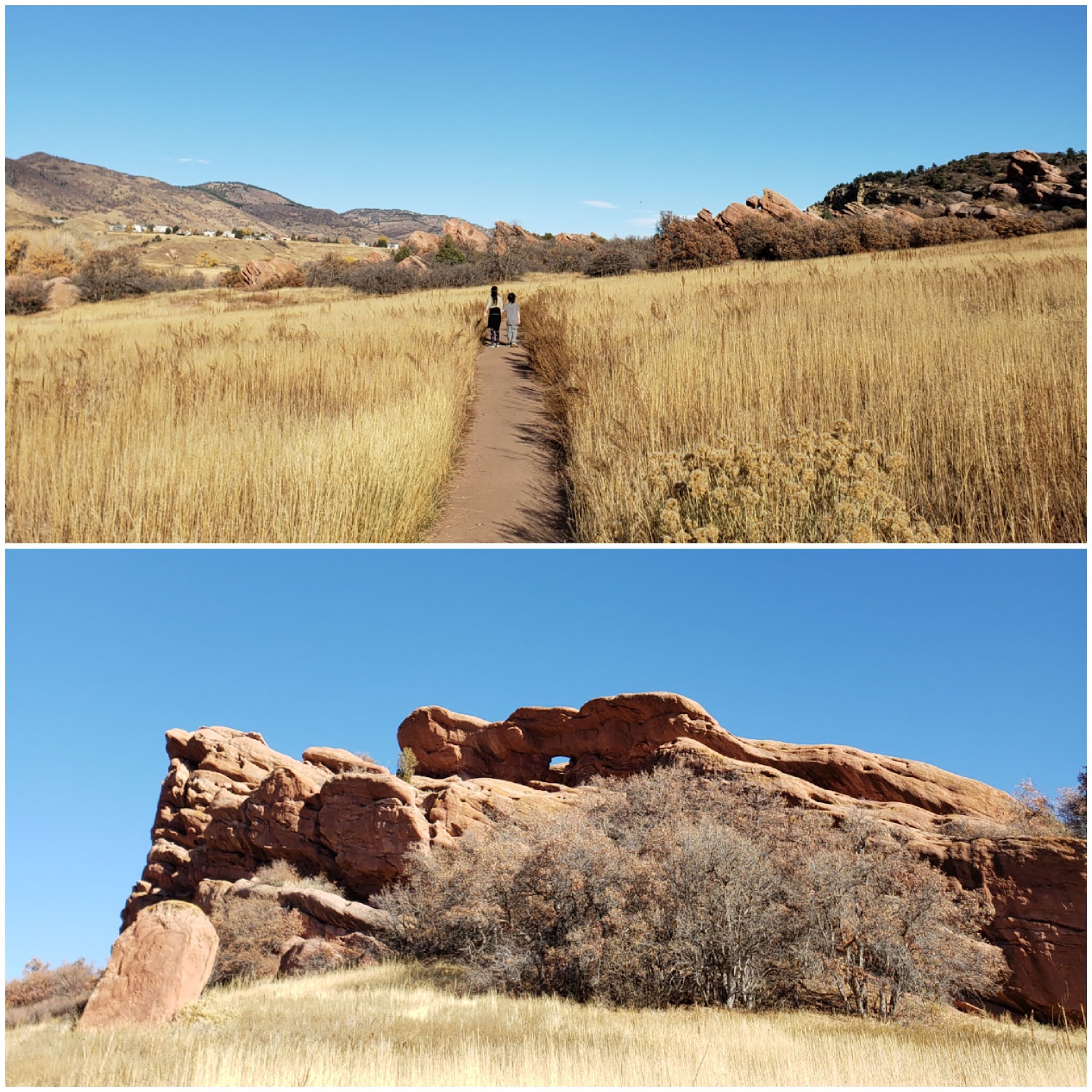
14 and a half miles with 2000 feet elevation. Ran on Rock Island Trail to Monument Valley Park, up through Sondermann Park, then over to Red Rocks Canyon in the late afternoon. It was breezy and I got a bit chilled. I was thankful for the hot shower after returning.


***

Wednesday, October 16th, 2021:

I started my gym workout with heavy barbell deadlifts. I didn't want to exhaust myself too much, so I didn't go fully until failure, and stopped doing sets once I started to feel the fatigue set in. Then I also did barbell overhead press, and barbell curls.

***

Thursday, October 17th, 2021:

This was the fun one! A true adventure run, one that required a little bit of uphill scrambling and some bushwacking. I encountered snow, cold, wind, thick fog, and amazing views.

I started my journey at the new-ish South Blodgett Peak entrance. This new parking lot is an alternative to the main Blodgett Peak Open Space, which easily fills early, especially on warm days (which this day was not.)

The plan was to go up the main trail, called the Wagon Wheel Road, into the National Forest and then through the wilderness until I found Road 303 at the base of Ormes Peak in the Rampart Range area, then run on 303 down to 300 (the main Rampart Range Road), and take this all the way back to town. A true mountain-crossing adventure! 

I followed the main trail upwards, as it climbs steadily but smoothly for the first mile.


Soon after the first mile or so, the trail gets much steeper and more rocky, similar to the trail on the other side of the open space that goes up the actual Blodgett Peak. It becomes a bit of a challenge.

I was anticipating this, but what I wasn't anticipating was finding a couch a little ways up from here!


I have absolutely NO CLUE how someone got this couch all the way up here. At this point, the trail is so rocky and rough that I had to be careful not to slip and fall down the rocky hillside. How in the world did someone carry this couch across this rocky terrain straight up the mountain? 

I didn't stop to ponder this for too long, though, as it was beginning to snow a little. Just small, lightweight, styrofoam snow. I had to keep moving to stay warm.

At least the views were impressive, with the colorful Gamble's Oak bushes surrounding me with their red-orange late-season leaves.


I was following a solid social trail for quite some time, until it mysteriously seemed to end or peter out. I was no stranger to blazing my own trail, so I kept climbing up through the wilderness, doing my best to navigate around the brush and fire-scarred downed trees (from the Waldo Canyon Fire.)

I kept climbing, without a defined trail, for what felt like a long distance. Finally, I came to a rocky outcropping at the top of a ridge. I thought, "I have to be close to the road." I stopped briefly to consult my GPS, and I was immediately disappointed. I was still quite a ways off from Road 303 - I wasn't even halfway there. I felt under-dressed for the cold wind that met me at the top of the ridge, and I hadn't brought gloves, which was an error on my part.

The styrofoam snow was coming down more heavily now, and I decided it was probably best to abandon the adventure for today and return back to town. I decided that I could try again when the weather was better.

However, I wasn't going to just turn around and descend the same way, without a trail. I knew from where I was located that if I could follow the ridgeline to the north, I'd be close to the main Blodgett Peak trail and I could hook into that and have a much easier descent.

I followed the ridgeline for a little way, and lo and behold, encountered a trail that I was expecting.

The trail went not only down to the east, but it also continued upwards to the west. My sense of adventure got the better of me! I decided to follow the trail upwards to see how far it would take me, and figured I could always turn around and descend this trail all the way if I had to. Also, the snow had subsided, and I felt warmer.

The trail was quite runnable for a bit, and I felt encouraged. I made up some distance, until the trail came to a rock outcropping again and just... ended.

But this time, I wasn't ready to turn around. I had been so completely convinced that I was going to turn around at the first ridgeline, but this time was different. I was almost at the elevation of the road - all I had to do was find the clearest path through the wilderness.

Some scenes from my trip through the eerie, charred woods, surrounded by clouds and fog.

I followed the GPS map on my phone as best as possible, but I did have to ascend and descend a few little gullies. 

I was able to see the road through the trees at one point, and it didn't look very far away anymore. As I got close to the road, a thick fog settled in. If I had been further away, I would have been more worried about finding my way, but at this point I was close enough that I knew I could make it.

Fog setting in near Road 303.

And then I popped out onto the road! The hard part was over. Now I just had 16 miles or so back to town. Most of which was downhill, most of which was easy, comfortable jogging on a gently-graded dirt road. No navigation necessary. 

Right at the point where I'd met the road, I found a cairn on the other side. I presume this is the cairn that leads to the trail up Ormes Peak. I had originally wanted to summit Ormes Peak during a trip like this, but not today. I was surprised I'd even made it to the road! I'll return to summit Ormes another day.

The cairn that must indicate the trail up Ormes Peak.

Even though I still had a long way to go, it felt good jogging on the dirt road around Ormes Peak. As I got closer to Rampart Range Road (300), the clouds moved away and I was no longer surrounded by fog.

Top: Jogging around Ormes on 303. Bottom: Looking back at the Ormes Peak summit. 

Looking south from Road 303.

When I was close to the junction with 300, Pikes Peak appeared. And it was an amazing view! 😍 I felt so elated. 

Pikes Peak in the clouds, near the 303/300 junction.


I enjoyed the views of Pikes and Almagre in the clouds as I joined Rampart Range Road. I knew I had a few miles of rolling uphill before the overlook, after which it would truly be all downhill. I was mentally prepared for this, since I'd gone this way during my Rampart Range Road marathon in June 2020. That day, these uphills were tiring and a good excuse to walk. This time, the cute little uphills felt easy. Nothing could bring me down now!

As I approached the overlook and high point, it began snowing again. But this time, it wasn't like the styrofoam snow earlier. It was big huge WET flakes of snow, and it was coming down fast!


It amazed me how quickly the weather could change from one mile to the next. I'd already encountered sun, snow, wind, fog, clear skies, and snow again.

The weather above Pikes Peak changed just as quickly. Went I reached the rock with the dedication plaque, the peak was totally engulfed in clouds.


But less than a mile down the road, I reached the overlook, and there she was, standing like a monolith above the rolling fog below.


Panorama from the overlook.

The sun was beginning to go down, but I was not too cold, and it was really easy downhill from here. I felt like I could spread my wings and fly all the way to Balanced Rock. My legs still felt good, despite all the scrambling earlier, uphill segments, and even my heavy deadlifts yesterday. The human body truly is resilient. 

As I approached the big S-curve in the road, I could see thick clouds hanging out down below. I was about to go into the fog again!


I coasted on the easy downhill as quickly as I could, wanting to make good time before it got totally dark.

It seemed like it went from light to dark quite fast. Maybe because I was engulfed in thick fog as it got dark. I could see the road right at my feet though, and that's all I needed.

Once I rounded a bend, the fog parted and I could see the city below.


Most of the way down, I was totally on my own. Few vehicles even ventured this way with this kind of weather. But when I was about 5 miles up from Balanced Rock, someone drove past me and asked if I wanted a ride down, or if I was ok. I politely declined, and I could tell he figured I would, since I was keeping a decent downhill clip. I told him this was easy peasy! Gentle downhill on a nice evening. After all, I did the climbing - this downhill was my reward! I earned this.


I still felt pretty good as I reached Balanced Rock at 22.5 miles. I've definitely felt worse at this point before. Lucky for me, since Alex was still on his way to pick me up. I jogged along the road towards the central Garden a little ways and back, accumulating a total of 25 miles before Alex met with me. And 4500 feet climbing today!

I know what they mean when ultrarunners talk about living "life in a day" during long races/ runs. I felt like I experienced so much, condensed into this short time frame. It was a treat to be able to accomplish what I set out to do, when I was certain I would turn back so early on. I'm glad I kept going, kept adventuring, and made it across the mountains ⛰ on this day.

***

Sunday, October 10, 2021

The first week of October in Colorado

Wow, what a week!

This is a special time of year in the mountains, and even in and around town on our urban trails. As such, my weekly mileage tends to increase around this season.

The day after my Tenney Crags run, we took a drive up I-70 west so the whole family could get some fall leaf-viewing. I'll start there.

***

Thursday, September 30th, 2021:

We drove up through Idaho Springs and Georgetown and saw some amazing fall colors on the way. We decided to go for a walk in "Bakerville," which is apparently a ghost town beyond Georgetown and before the Eisenhower Tunnel.

The scenery was amazing!


***

Friday, October 1st, 2021:

A nice 10 mile run on urban trails, 900 ft elevation gain. Later on, I did some standing chest flies with dumbbells. 

***

Saturday, October 2nd, 2021:

Over 8 and a half miles run, with again, 900 ft elevation. At Palmer Park.


***

Sunday, October 3rd, 2021:

Chin-ups with slow negatives, trying to build some supplemental strength. Also laying leg raises, engaging the core.

***

Monday, October 4th, 2021:

A nice run up and through Austin Bluffs Open Space, adding 10 and a half miles and 1100 feet elevation to the running logs.


***

Tuesday, October 5th, 2021:

A nice sunset walk with the family at Spruce Meadows. Lovely, cool evening.

***

Wednesday, October 6th, 2021:

It was time for another long one in the mountains!!! I hadn't filled up on mountain adventure for the season yet. 

This time, I started from Red Rocks Canyon. The clouds were picturesque all day, I must say, and I took a ton of photos.

The first ridge as you enter Red Rocks Canyon from the new 26th street parking lot. A cute little cloud!

Colorful Gamble's Oak.

I took the trail from 26th street to the south and passed through the entrance to Section 16, connecting to Bear Creek Canyon.

The clouds continued to entertain me.


This time, I took the Bear Creek Canyon Trail only until the connection to Captain Jack's, the legal route.

I decidedly prefer the decommissioned trail. The legal route is longer, with little rolling bumps that are preferential for dirt bikes.

The little up-and-down bumps just made me feel tired.

But soon after the four-way junction at the base of Kineo Mountain, the aspens were EVERYWHERE! 


Their magnificent yellows were almost neon in the sunlight.


I continued on Captain Jack's (#667) all the way until I found the old Bear Creek Canyon junction at the top, near the Lake Moraine Trail split.

I could hear some kind of construction going on at the South Slopes. I was a bit curious to see what they were doing, but not curious enough. I decided to avoid the area this time, and take the Bear Creek Canyon Trail downhill this time.

I popped out into the meadow before descending, just to get a peek at the peak.

Pikes Peak, America's Mountain.

The trees and branches that the forest service placed at the top side of the trail are still there. No one has yet brought a chainsaw this far up. 😕 This made for an annoying descent, dodging and picking the best route. I guess that's what they were going for. It did start off kind of fun, admittedly.

Soon I got to Jones Park, and the classic meadow that everyone loves. It was so gorgeous!!


I didn't know before that there was actually a geological survey marker on the rock in Jones Park.


I spent a minute taking in my surroundings, and then jogged down along the leaf-laden path until I came to the junction with the Loud's Cabin ruins. 


My basic knowledge of the ruins is that Loud was a guy who built a cabin here near Jones Park with the idea of running a halfway house on the way up Pikes Peak (kind of like what Barr Camp is along Barr Trail.) However, when the planned route up through Bear Creek Canyon to the summit of Pikes was eventually nixed, Loud abandoned his 8-person bunkhouse and its logs and old chimney structure have crumbled in disrepair. A really neat historical feature of our area! 

I kept going down the trail, but the clouds still continued to distract me with their endless wavy patterns.


I soon reached the part of the trail that I'd passed through a week ago. Exactly 7 days had passed, and I was stunned by the amount of change in the foliage.

The leaves on the aspens had gone from yellow-green and light yellow to deep yellow, tinted with orange. And the grasses, which had been bright-neon yellow with a tiny bit of green at the base, were now absolutely golden throughout. What a change!


Such an amazing opportunity to view the real changing of the seasons. 

After this point, I crossed back over to the Captain Jack's trail #667 and made my descent via Mt. Buckhorn, like I did last time. 


Shadows were beginning to get long as the sun made its way towards the west.

I descended Mt. Buckhorn, then High Drive, then ran back to the parking lot I'd started at in Red Rocks Canyon along 26th street.

I ended the day with just over 24 miles and just under 5300 feet elevation gain. I could not have asked for a better day. Fantastic!

***

Thursday, October 7th, 2021:

A full-on rest day, as I found myself more sore than usual from yesterday's adventure.

***

Friday, October 8th, 2021:

Dips, leg raises, front raises, and lightweight lunges. A pretty comprehensive weight routine, although mostly done with light weights this time.

***

Saturday, October 9th, 2021:

A good day for a recovery run in Palmer Park. 


Only 6 and a half miles, but almost 1000 feet elevation gain.

Fall truly is my favorite season for running. I just can't get enough!!

Thanks for reading and I hope everyone enjoyed the photos. See you soon.