I got to go to the real mountains, on a real mountain adventure! It even included the kind of rock-hopping, scree-climbing, grabbing-the-dirt, route-finding fun that I have been longing for.
But more on that in a minute! First, I wanted to review the last few days which have been fairly adventure-full as well.
***
Saturday, August 21st, 2021:
This day was mine and Alex's anniversary, and we went to Lory State Park for the first time. We hiked up a trail that went along one of the hogback uplifts that are characteristic of the area, and got an amazing overview of Horsetooth Reservoir.
 |
| A view from the first part of the trail, looking west towards the western part of Lory State Park. |
 |
| The lovely trail we ascended, looking back through late-summer meadows. |
 |
| At the top of the trail we took, there was a magnificent overlook of Horsetooth Reservoir, complete with small boats way down there! |
***
Sunday, August 22nd, 2021:
Today we took the kids out for a short walk and a splash in Tarryall Creek, up at the Twin Eagles Trailhead in the Lost Creek Wilderness.
A short hike from the trailhead brought us to the stream and a cold-water swim for the kids.
 |
| Near the Twin Eagles Trailhead. |
 |
| Swimming in Tarryall Creek. |

***
Tuesday, August 24th, 2021:
Today we headed out later in the afternoon and drove up to Elevenmile Reservoir. It was a lovely day. We took a stop at Wilkerson Pass and peered at the distant fourteeners. Then, we went for a walk down around the lake. Alex tried to catch a fish 🐟 and the kids got in the water by the shore for a bit.

 |
| Lovely clear water and a golden sunset at Elevenmile Reservoir. |
Before going back home, we found a dark spot and watched the twilight fading and the milky way appearing. It was so beautiful to see the full starlit sky, far enough away from the city lights.
***
Wednesday, August 25th, 2021:
Finally, after what felt like a month of wildfire smoke blanketing the state, I was able to go back to the mountains for a true adventure.
My decision for the day was to summit Almagre North. Partly, I decided to do this because, while I've stood atop the summit of Almagre South, I actually barely skipped the true summit of Almagre North during my last time up here in summer 2019.
I would approach it from the north, near the South Slopes Rec Area, and then descend to the south, making a big loop.
I started from the top of North Cheyenne Cañon, going up Seven Bridges (trail 622) until the junction with 667.
 |
| Moonset on trail 622, and aspens near the junction with trail 667. |
The sun was brightly shining as the moon set. The aspens are lovely and green.
I continued up trail 667 for a ways, until I reached the bridge over the South Ruxton Creek drainage, directly to the north of Almagre, and fairly near to the long northern ridgeline of the mountain.
Here I began following the drainage to the south and steeply uphill. Soon, I encountered what I believe was some cabin ruins near the green, flowing creek.
 |
| What I presume are the ruins of an old cabin chimney, next to the flowing South Ruxton Creek. |
 |
| A friendly little picturesque mushroom 🍄. |
I continued following the drainage until I soon broke out into a huge, steep scree field.
I saw the ridgeline to the west, but decided to just outright climb up the scree field before joining the ridge. I actually like the feeling of scree climbing, clambering up a slope on all fours in the dirt. It's a great feeling to be on such a steep slope with an open view in all directions.
I kept climbing up, grabbing at rocks and scree to keep from sliding too far back with each step. At one point, I accidentally grabbed a small high-alpine shrub, and suddenly a perfume-like scent wafted up at me. I investigated more carefully, and grabbed the shrub again, intentionally this time. A fresh, strong scent of orange peels mixed with anise filled the air. Amazing! The terpenes in this plant were overpowering. I couldn't get enough. Additionally, this plant looked so interesting that the photo just doesn't do it justice. It looked so waxy on the outer leaves that it almost looked like a fake plastic terrarium plant.
 |
| Top left: a small high-altitude shrub that smelled like orange peels and anise. Top right: the view up the scree field that I climbed. Bottom left: the view back down into the basin. Bottom right: small alpine flower. |
I'm always amazed by the alpine tundra and the flora that survive there in such a harsh environment. I think I see something new, some new plant or flower, each time I go.
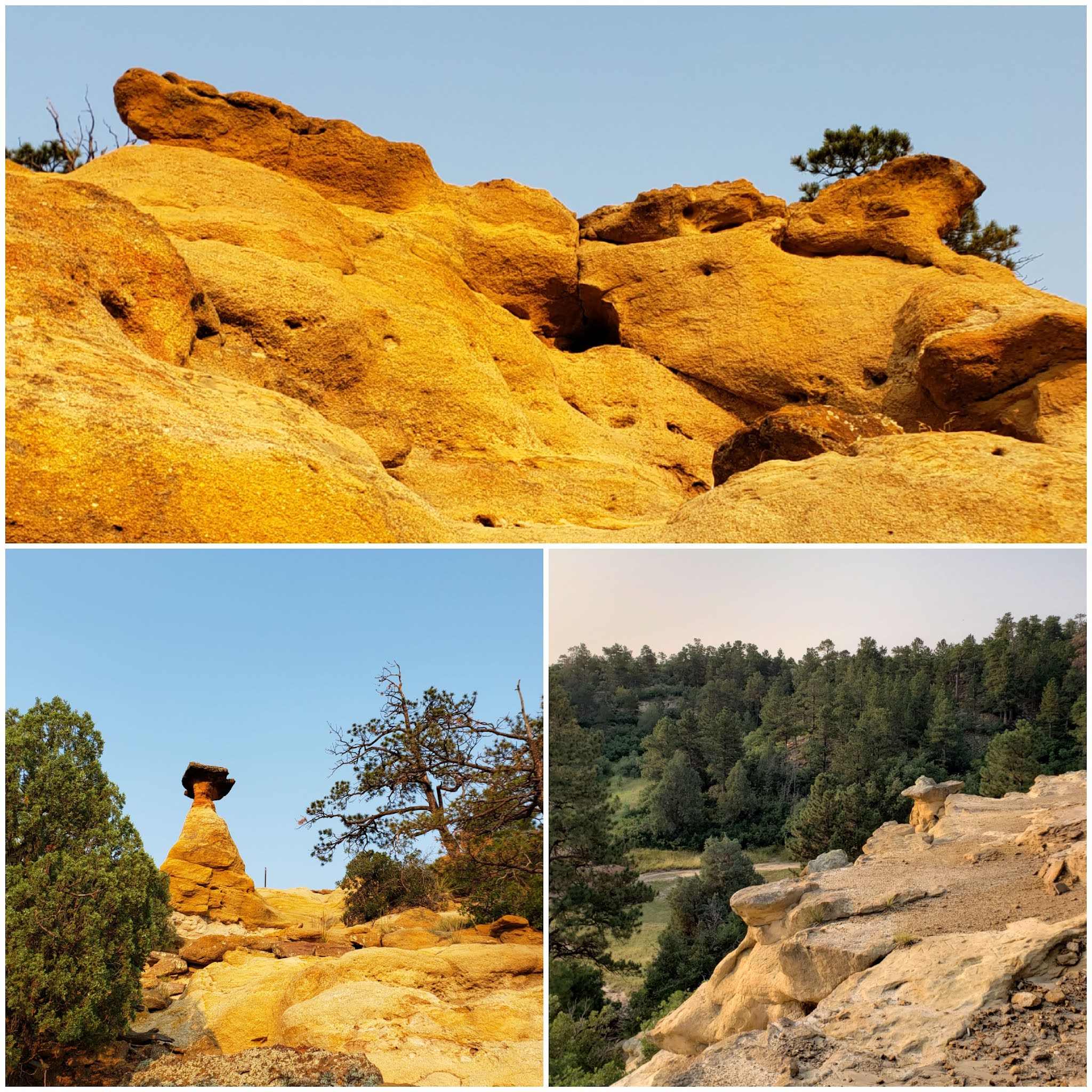
I kept scrambling up the scree slope and eventually trended to the west a little, coming to the join the ridgeline. This part was an easy class 3-ish scramble up jagged boulders. Route-finding was fairly simple, and the rock outcroppings were awesome to behold.
 |
| A really neat rock along the northern ridgeline of Almagre, with Pikes Peak in the background. |
 |
| Upper right: part of the ridgeline scramble. Bottom: view down to Lake Moraine. |
 |
| Some of the views along the ridgeline. |
 |
| Some more of the amazing flora that inhabit the alpine tundra. |
I was having a great time scrambling up and over rocks, route-finding and taking in all the views, when soon the ridgeline broke out into a huge alpine meadow of golden yellow grasses.
| Panorama from the alpine meadow just below Almagre North's summit. |
At this point I could see the Almagre North summit and knew I was within a few meters of the top. I quickly ascended the last few steps and sat atop to soak in the views for a short time.
 |
| Almagre North summit views. I especially enjoy the bottom photo, which is the view down into the Pikes Peak South Slopes Rec Area. |
I began making my way down the service road from the top, continuing in a southern direction. From here on, the remainder of my day would be straightforward, going downhill on the service road 379A to 379, then connecting to trail 701 at Frosty's Park, which leads to trail 668 (Pipeline trail), and finally rejoining trail 622 to close the loop.
But before I could get to all that, I wanted to play around in the alpine tundra for a while.
One of the reasons I love Almagre mountain so much is because of the huge variety of rock outcroppings that cover its wide upper slopes. I could probably stay up here for hours and climb various rocks, getting new and unique views from atop each one.
But I decided to settle on one particular rock that I had skipped on climbing last time I was up here due to lack of time.
 |
| More alpine flowers and views, including the (bottom-left) view down into the sunny Almagre Reservoir basin. |
 |
| Top: the outcropping I decided to scramble up. Bottom: the view down from it. |
I sat atop the rock, feeling like the king of the mountain. But within a few short minutes, a bitterly cold wind began to blow, reminding me that I was but a visitor to this unique landscape, and my time was almost up.
 |
| Top right: stream and boggy land in the Almagre Reservoir area. Bottom left: Almagre dam. |
I continued my descent down the road, admiring the views to the east of Colorado Springs and Mount Rosa with her wide, sandy northern saddle.
 |
| Colorado Springs down below Mount Rosa's massive slopes. |
The mountain thistles along the road 379A were gigantic. They had huge hairy heads with multiple "eyes" that attracted all kinds of bugs, including cool-looking iridescent blue bees.
 |
| Top: wooly mountain thistles, standing between 3 and 4 feet tall. Bottom: the pretty little marsh near the junction of FS 379A and FS 379. |
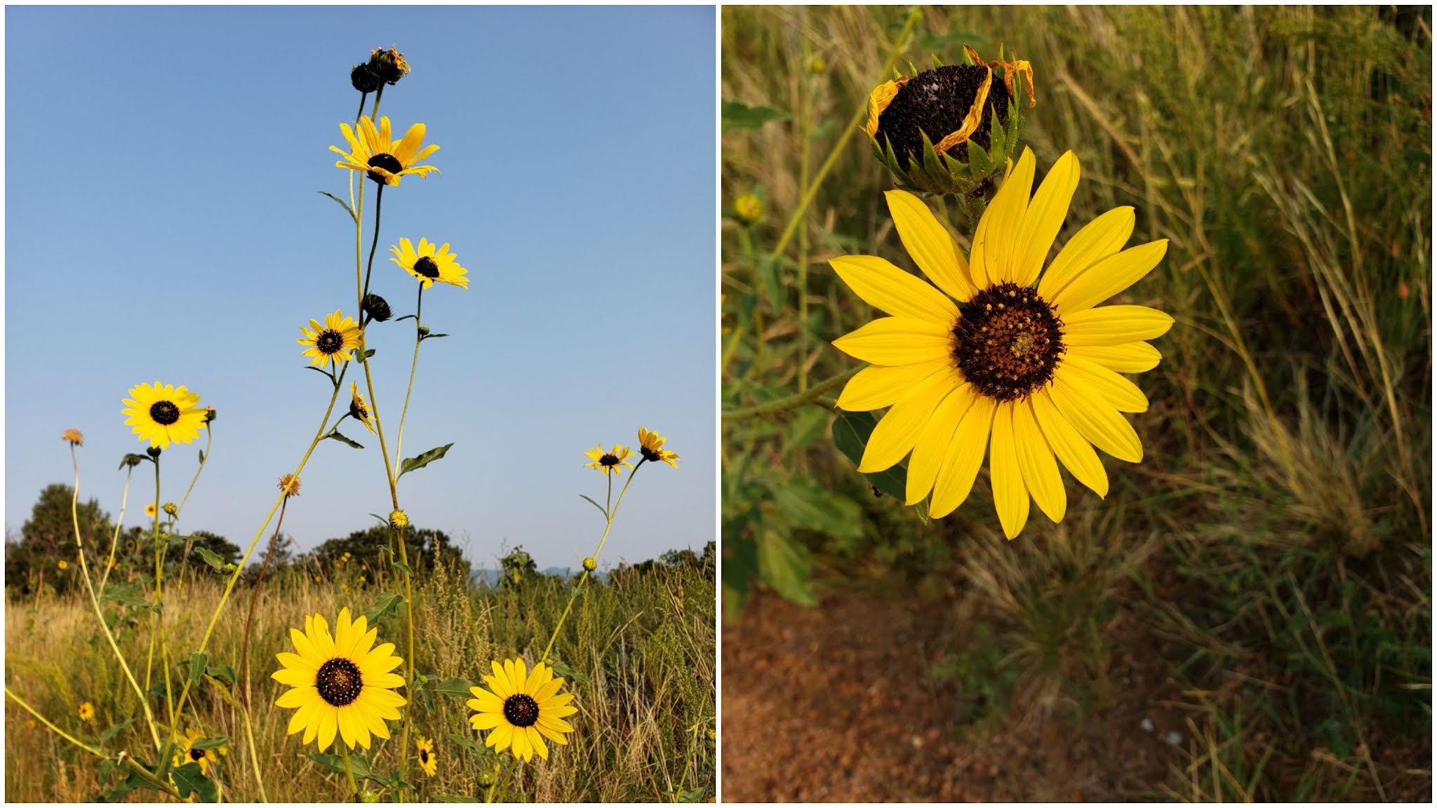
I summoned the energy to begin jogging downhill. The evidence of the wet spring and early summer is still abundant, with green streambeds and bright wildflowers still coloring the hillsides.

I finally crossed all Seven Bridges, finishing my adventure the way it had started.
Wow! What a day! I had experienced so much nature packed into one day. A challenging uphill climb along the northern ridge of Almagre, unique aromatic plants, rock-hopping in the alpine tundra...
And I'd ended up with almost 22 miles total with nearly 6000 feet elevation gain. I'd call that a good one!

Thanks for following along! As autumn quickly approaches, I hope to experience more of my favorite season in the mountains.