After last week's Mt. Herman loop with Sharon, I knew the aspens would be changing colors, as well as the autumn weather ushering in the snow soon. With that in mind, I convinced Dionne to go to the Colorado high country with me before it got too cold and late in the season. We decided to do the Pawnee-Buchanan loop in the Indian Peaks Wilderness.
This popular running loop is around 27 miles and 7800 feet elevation gain.
We set out on Sunday the 29th very early, arriving at the trailhead with the stars still filling the sky.
During our drive up, we passed through a lot of fog in Boulder. Our drive took us up through Left Hand Canyon. By the time we reached the Brainard Lake area, the fog had completely cleared and the night sky was gorgeous.
"Is it snowing?" Dionne asked as we first set out from the Long Lake trailhead. Yes, it was just barely snowing! Likely just some remaining condensation from the fog that was mostly below us now.
Unfortunately we went slightly wrong at the very start by the first lake, so we'd already added half a mile to our day before we began. No big deal overall.
On our second pass by the lake (in the correct direction), the early astronomical twilight was reflecting off the water. A clear and beautiful indication of the day about to start!
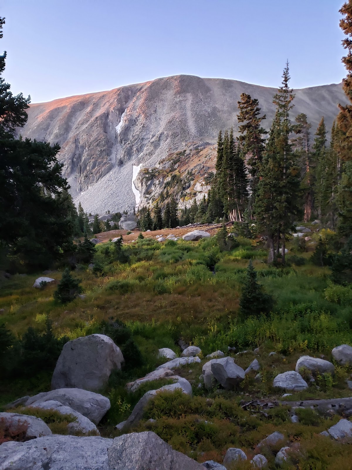
Soon we were at the first trail junction, with Navajo, Apache, and Shoshone Peaks in front of us. These jagged 13ers dominated the skyline during our first climb, towards Pawnee Pass.


The robust-looking Mt. Audubon with the last moments of pink-tinged alpenglow stood in front of us as we climbed.
Soon the sun was high enough above the horizon to color this rock wall bright orange with its morning light.

Looking back towards the east, we could see the fog that we drove through in the morning in Boulder and just outside of Boulder in Left Hand Canyon. Wow, it was cool to see the sea of clouds so far below!

It wasn't long before we were above treeline, in alpine tundra, and near the top of Pawnee Pass.


And then, there we were! The top of the Continental Divide, and the first and tallest climb of our day. It was cool to still see the clouds way down below.


The wind at the top of the pass wasn't that terrible, but once we started descending the pass to the west... wow, we entered the wind tunnel!
The winds were extreme. At one point I almost got blown down by it. Nonetheless, I could not take my eyes off the gorgeous views. That clear blue lake off in the distance is Lake Granby!


After this point, the trail descends steeply into a sharp canyon, surrounded by jagged rock formations. The landscape is barren and dramatic. I told Dionne later that I felt like I was on a grand quest towards Mordor!


Look closely! You can see Dionne on the "trail" - more like a scree gully with overhanging rocks above.


The wind was still brutal this whole way. Furthermore, we descended into the shadows, making the transition from the daylight at the top even more drastic.
We continued to descend toward Pawnee Lake.

And then we passed the lake, and continued descending even more. In fact, we descended so much that I started to get worried! It was a lot of downhill.
From the bottom of the valley, the classic picture of Lone Eagle Peak came into view. (It's the pointy one.)

And from here on, the fall colors got better and better. I was exhilarated by the beauty of it all.


We passed by several pretty waterfalls.


And finally, it was time to start climbing again on the way to Buchanan Pass!


We achieved treeline fairly easily, and the wind atop Buchanan Pass was significantly less than the wind atop Pawnee Pass earlier in the day.


Descending from Buchanan Pass to the east, the ground was covered in beautiful red foliage! The sharp autumn sun above treeline made everything so much more bright and bold.


Soon we'd descended to the Coney Flats area, and we were ready for our third and final climb, back up towards Brainard Lake.
The last climb of the day was deceptively long, as it isn't a named pass, but still reaches treeline one more time before the descent into the Brainard Lake Recreation Area where we'd started.
On this last climb, Dionne was pretty beat and ready to be done. I think the EnduraLite that she had shared with me was working, because I still felt like I was in decent shape for being well over 20 miles into this venture.
The view to the north from this part of the trail was a massive panorama of the south face of Longs Peak and the high points of Rocky Mountain National Park.

I think it's so cool that from this loop, we were able to see both the east and the west sides of RMNP, which is a huge National Park!
Finally, as the sun was beginning to go down and the shadows became longer again, we returned to Brainard Lake.

It took us almost exactly 12 hours to do the whole loop; 6am to 6pm. Wow - what a long, tough day! We certainly weren't setting any speed records, but it doesn't matter - the experience alone was completely worthwhile.
We drove home through Coal Creek Canyon instead of the way we came (through Left Hand Canyon), so even the drive itself was somewhat of a nature loop, too.
This amazing journey covered so much territory, and such a variety of sights! From the windswept heights of the Continental Divide, the cragged and exposed descent from Pawnee Pass, to the rich Aspen-filled valley below, and back up to the red-tinted meadows beyond Buchanan Pass - it was like packing a whole lot of life into a single day.
Thanks again to Dionne for going with me on such an adventure! And special thanks to my husband Alex for holding down the fort at home while I let my soul wander through nature. The Indian Peaks are a special place, a spiritual place, and a place where one can find a kind of lasting contentment that permeates forward into the coming days and weeks.
No comments:
Post a Comment