Friday, July 29, 2022

Vegas vacation photo album

This isn't a typical blog post from me! The last week has been busy with helping my folks move back to Colorado from Arizona.

But on the way down to Phoenix, Alex and I traveled to Las Vegas first, and took a couple days to visit the sights and sounds of the city. 

I had such a blast walking the strip at night and seeing all the lights, then visiting Fremont Street as well!

The story of our travels (in photos):

I ran a last chance 10k in Palmer Park the afternoon/ evening before we departed. (Wednesday the 20th)

We traveled west on I-70 through western Colorado and watched the landscape change from high mountains to mesas.

I-70 west travels from Colorado through Utah, where we picked up the I-15, which cuts through the corner of Arizona before entering Nevada. 

We still wore our masks when we walked the strip, since it was pretty crowded as it was a Saturday.

Sunset on the Las Vegas strip.

Some cool Vegas landmarks. 

Saturday night on the strip! Just about as many cars below as pedestrians above.

Our last stop on the Vegas tour was Fremont Street. Very colorful!

After our night in Vegas, we continued on to Phoenix and spent a couple days moving my parents back here. That was enough of a workout within itself!

I finally got back to my regularly scheduled running routine, getting 7 miles (flat) on Thursday the 28th.

Now that I'm home, and the weather has cooled off a bit, I've got my sights set on some upcoming ultramarathon adventures! More soon!

Tuesday, July 19, 2022

Week of July 11th to July 18th, 2022

Monday, July 11th:

A lovely rest day, with a family walk in the evening of a couple miles at Spruce Meadows Open Space.

Another amazing Colorado sunset at Spruce Meadows Open Space with the family. 

I love this open space, it's one of the better-kept local secrets. 🤫 It consists of open high prairies and views of the surrounding mesas.

I've run the 8-mile loop around this open space a number of times in the past. The rolling prairie is a gentler run than the mountains, but just as pretty.

***

Tuesday, July 12th:

Machine pull-downs and machine chest press in today's weight session. Even with the equipment, I always try to go slow and really contract the muscles involved.

I followed up with 45 minutes on the exercise bike, at a casual speed.

***

Wednesday, July 13th:

Wow, an amazing afternoon/evening run!

Over 1700 feet elevation gain.

It was very hot at the outset, 91.3 degrees as the photo shows. But the overcast skies kept the punishing sun away; it was a great heat-training day. I like to incorporate some hot-day training runs, to feel comfortable keeping a steady pace in 90-degree heat.

I ran up Palmer Point trail along the west side of Palmer Park, connecting to Marconi Heights, then Austin Bluffs Open Space.

Overcast skies made 91-degree weather tolerable, even pleasant. Palmer Point (top & middle), and Marconi Heights (bottom). 

From Austin Bluffs Open Space, I ran out to the overlook. Sitting atop for a few minutes, I looked out towards the mountains. 

I visually mapped the rest of my route for today, and looked beyond, for a future upcoming run. I have in the works a 45-mile route that will trace what I did today, then continue north-westward to connect to Ute Valley Park, South Blodgett Peak, and up to Rampart Range Road. Then I'd descend all the way down to Balanced Rock before connecting back home through the Garden.

Today, I wanted to try out the connection to Ute Valley Park, from a trailhead I'd never been to before.

So I climbed down from the overlook and connected to the primary trail through Austin Bluffs Open Space, jogging west and bypassing the Windmill Project on UCCS, with Pulpit Rock in the background.

I kept on the trail and went through the student tunnel at University Village, linking into the Pikes Peak Greenway for a moment. I soon switched to sidewalks until ProRodeo Drive, where I would latch into the eastern Ute Valley Park trailhead.

I didn't even realize this trailhead existed until recently. On the Google map, it doesn't show that this trail is even part of Ute Valley, unless you zoom way in and you notice a small waypoint called "Ute Valley Parking and Hiking Trailhead 2."

When I arrived, the trail was marked "Black and Blue Loop." I entered this part of the trail just ahead of a couple cyclists.

The trail rolled up and down, along pine tree-lined trail. There were a couple neat rock formations, and then Blodgett Peak came into view through the trees.

Views from the overlook at Austin Bluffs Open Space (top); the Windmill Project with Pulpit Rock  behind (bottom); and the Black & Blue Loop looking towards Blodgett Peak (right).

When I do the 45-mile day, I'll continue on this trail through the main Ute Valley, all the way to the northwest corner, when I'll cross Centennial Blvd and quickly connect to the S. Blodgett trailhead.

But for today, I stuck to the Black & Blue Loop. I could hear the cyclists behind me. I was instantly enthusiastic. This was a fun challenge! Even though cycling is generally faster on flats and downhills, this trail had a number of somewhat rocky, albeit short, climbs. I would quickly drop the cyclists on the climbs.

I after I popped out of the Black & Blue Loop, I turned southwest on the trail toward Piñon Valley Park.

Here, the cyclists had taken a pause, and I asked them if they had been the ones just behind me since the trailhead. They said "yes, we almost caught you, but you were too steady." This was the biggest compliment I could have gotten!! My pace was so consistent that I had bested the "challenge" I'd set for myself to stay in the lead of the cyclists.

I took a last look to the trail that continued to the northwest, the route that I'll be taking when I head toward the Blodgett Peak portion of my 45-mile planned escapade.

Instead, I climbed on a trail - I believe it was actually named "Winding Woods Trail" - through the woods to the Piñon Park trail entrance. Then, I ran through the neighborhood for a short time, crossing Garden of the Gods Blvd and linking into the Sinton Trail, which I took back to the Pikes Peak Greenway and home. These trails will also make up a portion of my future big loop route, too.

With the long daylight hours, I was even able to make it home during the nautical twilight this evening, with bright yellow light still beaming from behind the Rampart Range. The orange-glowing moon was just beginning to rise. 

I accomplished over 17 miles in town today, and saw some new trail connections for the loop that I have planned 😀. I practiced jogging at a pace that I'd be able to do the whole 45-mile loop at, and it was just under 14 minutes per mile. Based upon this data, allowing myself some extra time for stops and photos and the major climb through the National Forest towards Ormes Peak, I think I would be able to do the 45-mile loop in about 12 hours. This gives me an average pace of around 16 minutes per mile.

Here is the planned route:


It might be a couple weeks before I have time to complete this route, but it's nice to have all the plans worked out! 😊 

***

Thursday, July 14th:

I noticed only mild sorness from the 17 miles yesterday. So I did the elliptical for a little while at an easy pace, just to loosen up, and ended up doing 2 hours and 15 minutes total, (with a few breaks!)

***

Friday, July 15th:

11 miles total today, split between two runs. I don't usually do "doubles," but that's just how it worked out today. First was a walk/jog of 5 miles, with a more consistently-paced 10k later on. Mostly flat today!! Also a few front raises, with only 10 lb weights.

***

Saturday, July 16th:

7 miles, mostly flat. This is shaping up to be a good week!

***

Sunday, July 17th:

Rest day.

***

Monday, July 18th:

Back to the trails for another solid 12-miler.

I wanted to pad my run with some extra mileage at the outset, heading out-and-back to Grandview Overlook on the road.

Then, it was all trail for the rest of the miles, heading down through Greencrest, up Marconi Heights, and back down the dirt road to UCCS where I joined the Tava Trail. I finally returned to Palmer Point Trail to wrap up my day.

12-miler on July 18th.

It was mostly overcast, but still fairly hot. No rain or drizzle this evening. I didn't bring water and felt fine the whole way, even 12 miles in 80-degree heat, so I think I'm adjusting to the hotter summer temperatures pretty well.

I feel like my weight is in a good spot, too. Not too bulky for the trails, but muscular enough to power up extensive climbs. I was sitting right at 139 lbs after returning from this run. 

This was a good, solid week. I'm really feeling confident about my upcoming long runs!!

I hope to be approaching the 40-mile distance soon. But first, I have to head out west to Arizona for a week or so. I'll be pretty busy, so I'm not sure if I'll be able to fit any running in, but we will see!

Monday, July 11, 2022

Week of July 3rd to July 10th, 2022

Sunday, July 3rd:

Gym day! Side lateral raises and kettlebell toe squats. Those toe squats sure do feel helpful for lower leg and even plantar strengthening.

***

Monday, July 4th:

My first run since my big one on the 30th. A midday recovery run of 10k. It was hot out, but windy enough that I didn't feel too overheated. But when I got back and stopped running, I felt like I was covered in a sheet of water. Warm day!


Also, since they closed the park to vehicles for the 4th, I had the run of the roads, which was nice.

***

Tuesday, July 5th:

We went with the kids to Elevenmile Reservoir, and walked about 3 miles around the lake. It was overcast but not too cold.

It was another lovely day that made me so thankful for living in this amazing state. There's so much beauty to see!


***

Wednesday, July 6th:

Full sets of barbell bicep curls first. Then, rotating pushups into planks. Basically, when I'd start to feel fatigued from the pushups, I'd go into a high plank and hold it for as long as I could. I didn't time them this session, just trying to stick it out until my abdominals felt like they couldn't take anymore. Also a good workout for the transverse abdominus.

***

Thursday, July 7th:

80 minutes on the elliptical. A nice cross-training day.

***

Friday, July 8th:

10.7 miles, beginning with a run up to the small hill along Palmer Point.

This small hill is actually a superb overlook spot. I looked for a minute to take it all in.

Up on top, I could see my whole world. It was peaceful, with distant storms over the far back side of Pikes Peak. The clouds weren't threatening and the birds were singing.

I could see parts of all my recent long run routes. Almagre, Mt. Rosa, and landmarks like Garden of the Gods, where I spent a fun summer working as park safety.

It was just a gorgeous evening to reflect for a few moments on everywhere I've been and how far I've come in this life.

Then, I climbed the northern mesa to the top of the park. At the top, I was treated to the most gorgeous sunset! Wherever they were, people had stopped along the trail to take it in.


Then I ran out to Grandview and back twice, watching the distant storms over the Rampart Range. The lightning was impressive!! As I wrapped up my run, the storm seemed to be slowly encroaching on the town, but I was already home safe, showered and relaxing 😎. 

***

Sunday, July 10th:

Over 8 miles in Palmer at sunset.


I was fascinated that, at the start time of astronomical twilight, the sky was still exceptionally bright. Although astronomical twilight is often indistinguishable from night in many cities, this evening the setting sun illuminated the clouds above the mountains. Interestingly, my phone camera couldn't pick up how bright it really was to the eyes.

Every sunset is unique 😍! I wish I could experience them all while running, but I love to see them when I can.

***

All in all, a nice week. No upcoming big runs on the menu quite yet, as I've got a few busy weeks ahead. But I have a few ideas 💡 kicking around for later in the month!

Tuesday, July 5, 2022

Storms on Middle Almagre

On Tuesday, June 28th, we took the family for a summer drive and tour through the Lost Creek and South Park areas.

We picnicked at Tarryall Reservoir and drove on Highway 77 all the way through to 285, taking in the sweeping views. What a lovely drive!


Then, on Thursday (the 30th), I was ready to go back to the mountains for another long one!!

My goal for the day was "Middle" Almagre. Almagre Mountain has north and south summits, both of which I've been atop in the past. But these summits are adorned with radio towers and human structures. Instead, I wanted to scale up one of the smaller sub-summits in between the north and south summits, and climb the tallest rock formation on top. It sounded more picturesque and natural. Unofficially, I call this "Middle" Almagre.

I began my day at the top of North Cheyenne Cañon, and headed up the Seven Bridges trail. It was fairly busy, up until the last bridge. After that point, the trail quickly became extremely quiet.

I made my way from 622 to 668, the Pipeline Trail. Clouds were building a little over my favorite valley. 

Soon I was back in the woods on my way towards Nelson's Camp, and I stopped paying attention to the sky, since the Colorado wildflowers were so abundant and amazing!

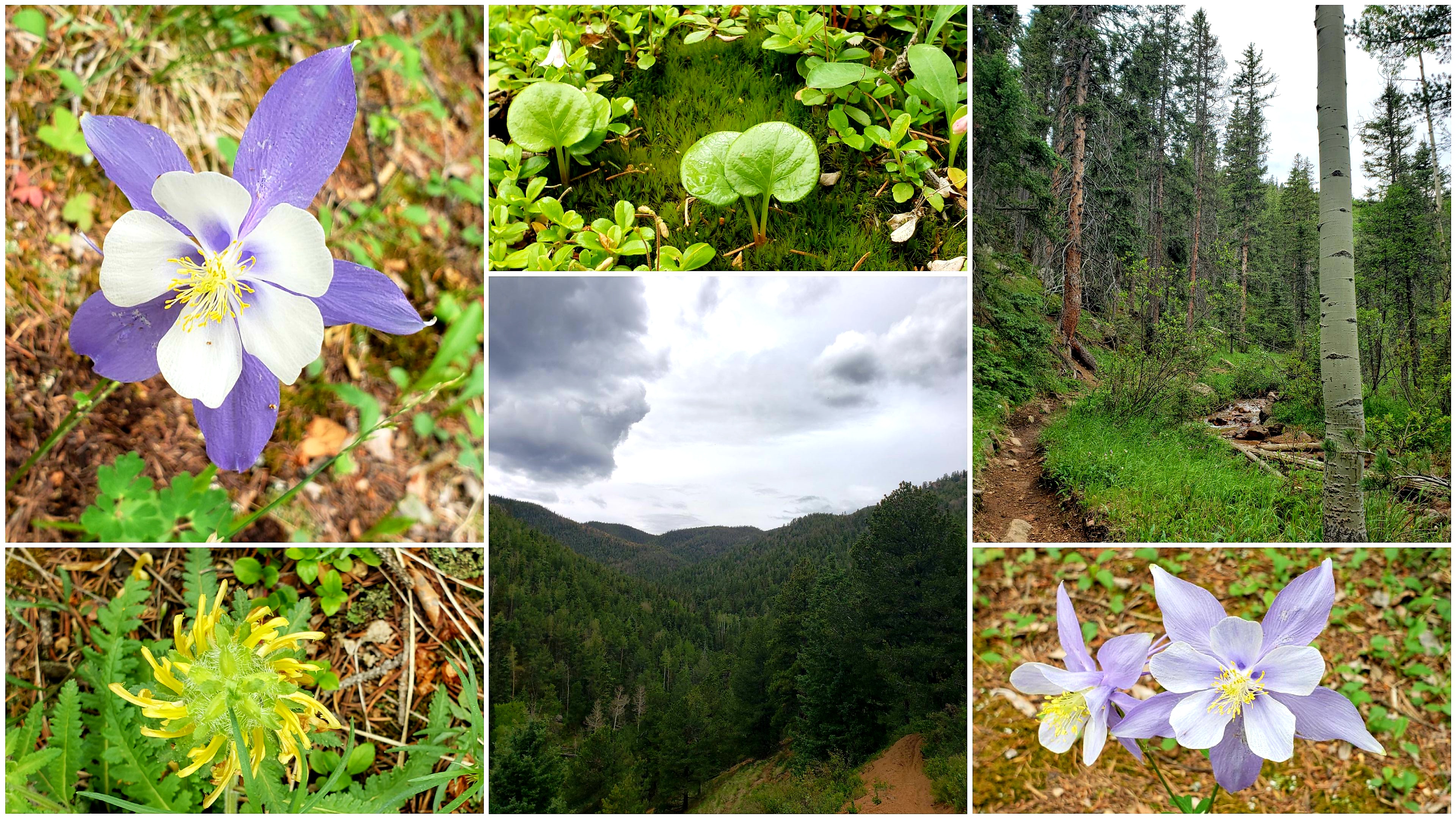
There they were, in every variety and color. And the columbines! The columbines were like purple little starbursts, popping up throughout the forest and along the main tributatory of N. Cheyenne Creek, which was still flowing quite well from the late-season snow.


At the old metal sign at the creek crossing, I turned west to follow the main flow of the creek, up towards the old Mt. Baldy Reservoir basin on top. This is the "standard" route up Almagre.

I've been on this trail many times in the past, and it used to be hard to follow in a few areas. But this was the first time I've been on this route this year, and the trail was very solid, easy to follow, and even carefully cairned at critical junctions.

Someone put in a lot of work to make this trail really nice!! I was so pleased that the trail was so easy to follow. The trail passed through a "bumpy" aspen forest and climbed beyond some steep crags.


Before I knew it, I was climbing close to the treeline and could see the Almagre Reservoir dam just ahead of me.

The view down into North Cheyenne Cañon and Colorado Springs beyond was filled with rain clouds, but it was dry where I was.


I reached the dam, and the alpine tundra. The tundra was filled with amazing wildflowers of all colors! It was impressive! Even the mosses were blooming.


The sky was cloudy, but it wasn't stormy or raining, and the flat, empty reservoir basin was calm and not very windy, with intermittent sunlight. 

I headed directly for the Middle Almagre summit. As soon as I climbed up to the ridgeline, a powerful gust of wind hit me.

I could see the South Slopes Rec Area a thousand feet below me to the west, with the Crestones and other distant 14ers decorating the western skyline.

As I scrambled up the short final ridgeline, Pikes Peak came into view, with a light green tint on its southern face, which I knew was actually a soft carpet of alpine grass.


I spotted the summit outcrop, and found that it was simple to get on top. It wouldn't even call it a "scramble" - more like a step-up!

From the summit of Middle Almagre, I could see a fantastic 360-degree panorama! There were some heavy rainstorms over the Westcliffe area to the southwest. But the most dramatic clouds were building over Bull Park, just on the other side of the South Slopes lakes.

"Middle Almagre" summit panorama. 

I sat on the top of the summit outcrop for as long as I could stand the wind. I loved looking at the views of the distant 14ers, with no smog or smoke in the air today.

Reluctantly, I decided it was time to descend and begin my return trip. I downscrambled the short ridgeline back to the Almagre Reservoir basin. As soon as I reached the basin, the sky crackled loudly. Lightning erupted and struck somewhere over by Bull Park, just to my northwest.

I had pushed my luck with the building storms. Now I had to get off this mountain, and fast. Adrenaline surged, and I ran downhill on the road 379A. This was the fastest way to escape back to treeline.

A cold spitting rain began, chilling me. But my pace to the south was faster than the storm encroaching from the north, and I quickly emerged from the rain. I slowed from my downhill sprint, and took a few more photos of the wide view down into North Cheyenne Cañon, and Mount Rosa to the south.


But the storm wasn't done with me. At the junction of road 379 and the 4-wheel road 370.C, the rain had returned, soaking me and chilling me to the bone. I sheltered under a tree for a moment, but the cracking thunder told me I hadn't much time to hesitate. I opted to continue to the south, following the 370.C road for a quick descent to Gold Camp Road, although I knew it would add some mileage to my day.

I just had to get off this mountain quick, and it turned out that 370.C was the perfect way to do that. The rock-strewn road descends sharply through thick forest. 

Soon, the storm began to dissipate, and the electricity gave way to a gentle pitter-pattering of drizzle. I was rock-hopping with a fresh energy, and my fear had evolved to joy. I loved this road! It was like a hidden gem, with views of Mount Big Chief to the east, and unique rock pinnacles to the west.


Soon I'd reached Gold Camp Road, although a few miles further away from town than my usual descent route. But I was certain now that I'd picked the right way to go, as the storm had nearly cleared, it was no longer raining, and the birds were singing all around me.

I began my long journey back to town now, with at least another 14 miles to go. However, it was all easy dirt road mileage, and totally doable. My confidence was up from last time I'd done this road run. All I had to do was put in the work!


I enjoyed the green valleys and the craggy rock formations - "old gods" that stood tall, made of Pikes Peak granite, watching over these mountains.

I felt good overall during the whole way back to town. Maybe I'm getting used to the ultra long road runs! Hopefully that means I'll be able to succeed in the Silver Rush 50 miler someday, which is one of my long-term goal races. I believe it has a decent portion of high altitude dirt road running. 


When I finally got back to town and finished, my distance exceeded 27 miles. A nice total for a crazy day! And, even though I'd had to escape from the lightning above treeline, I'd had an amazing day and made my summit goal.

It's been shaping up to be a great summer so far, training-wise! Soon, I hope to do a 40-miler and then eventually go for the 50-mile, which is my main goal for the year 😀. The training has been helping to build my mental long-distance fortitude, but I'm still a bit anxious about attempting the big distance.

This big Almagre day was a good one for me though! Hope that you enjoyed the photos and journeying with me.

Monday, June 27, 2022

Weekly summary, June 20th to 27th, 2022

After my Mount Rosa loop on Friday the 17th, I took a few days off immediately. My left shoulder was paining me quite a bit. The first night, a small muscle seized up in my back.  Fortunately, it resolved itself within a few days.

I still realized I likely overextended myself between the heavy deadlifts a few days prior, follower by the 27 miler (especially with carrying the heavy water pack).

On Monday evening (the 20th), I did 45 minutes easy on the exercise bike. This was the perfect recovery exercise, and I felt like it got the blood flowing without any risk for injury.

I got back into it with a slow 8.5 mile recovery jog on Tuesday the 21st.

8.5 mile recovery run at Palmer Park.


It was overcast and not overly hot.

Another full rest day followed, and then I did another short run of 6.75 miles on Thursday the 23rd.

6.75 miles at Palmer Park, on lovely trails.

This run was quite a bit hotter by contrast.

Still, it was such a beautiful day, and I just enjoyed that southwest sun as I topped out the bluffs and viewed the mountains from afar.

I stuck to trails, enjoying the rock formations and making a big loop around the park.

By Friday the 24th, a week after the long run, I felt ready to get back to the weight room. My shoulder felt back to 100%, but I still wanted to be extra careful.

So I chose to do only one exercise, which was lightweight squats. I didn't really want to squat a heavy barbell yet. Instead I took a single 25-lb dumbell and held it out in front of myself as I squatted for about 15 to 20 reps, with about 7 or 8 sets.

I followed up with 45 minutes on the exercise bike, like earlier in the week.

This weight session felt great overall, and I felt I'd be ready for a real heavy lifting day soon.

On Saturday, I simply hit the exercise bike again, for an hour this time, and at a bit faster/ more athletic pace this time. It's such an accessible cross-training exercise, since it's right in my gym.

On Sunday, Alex and I went to Denver Pridefest!! It's been three years since we've been - since before the pandemic. Still, we wore masks and stayed away from the main part of the crowd. It was nice to be able to take this day off and walk around the festival and enjoy spending time with my husband!


On Monday the 27th, I headed out for a mid-length jog and ended up with 13.5 miles. It was another beautiful Colorado day. I went out-and-back on the road to Grandview Overlook twice before adding some more mileage on trails.

13.5 mile day in Palmer Park, with clouds building over the mountains but sunshine 🌞 in the park.

I was pleased that my pace was fairly quick as compared to my last couple runs. I now feel totally recovered from my Mount Rosa jaunt, and I didn't overextend myself by doing 13.5 today. 

As the primary summer training season is here, I am planning to head to the mountains again as soon as I can - maybe even later this week! I'm planning on hitting up Almagre Mountain, one of my usual summer favorites. See you on the trails 👣! 

Sunday, June 19, 2022

Beating the heat on Mount Rosa!

The last couple weeks have seemed busy! Overall, my summer training has been going well - a fair mix of weights, rowing, running, and working on the yard and house.

Here's a few photos from my training the last couple weeks in town. The flowers in the city are in full summer mode.

Clouds quickly building over Palmer Point Trail, on my way out versus on my way back, on a 9 mile run.


Wildflowers of a variety of colors in Palmer Park. Stunning!

***

The town runs and gym training have been consistent. But as you all know, I love nothing more than putting my training to use in the mountains.

Originally, I wanted to do a mountain run on Monday, but it was going to be 95 degrees and it was already fairly hazy in the morning.

Since I knew the haze would make it harder to see the distant 14ers from the mountain summits, I decided to put the mountains off until later in the week. Hopefully a cold front will at least clear the haze, and I'll go on a day with temps only in the 80s instead of 90s!

Instead, on Monday, I did a pre-planning run for this mountain run.

Austin Bluffs was the perfect location for this. I really enjoy how I live close to the bluffs and can top them out for a good view of the mountains and trails.

It was super hot out, and the sun was beating down already even though it was really early. I ran up and over Palmer Park first, trying to stick to the shady canyon trails.

There was nothing I could do to avoid the sun and heat once I went up Marconi Heights.


Soon I arrived at my overlook for the day, up above UCCS. And a set of pull-up bars, too!

Similar pull-up bars are found throughout the parks in the local area.

I found a nice shade tree and observed the mountains for a few minutes. There's almost no snow remaining anywhere in the Pikes Peak region. Full on summer trail conditions everywhere. Of course, that's expected with 95 degree temperatures in town today! 

Pullups and panoramas on the bluffs.

I did a few pullups before returning home and planning out a few routes.

I will try to do my next mountain run on Thursday or Friday this week.

***

On Tuesday, I had a great heavy lifting gym day. Barbell deadlifts were called for, and I'm glad I did them. What a great overall strengthening exercise! Followed up by standing curls, for some supplemental upper-body work.

***

On Thursday, we took the family and visited Clear Creek Canyon, outside of Golden. They've made a number of improvements to the trail in recent years.

It was a lovely day for a walk along the creek in this steep, jagged canyon. And then just hanging out by the water with the kids! 

Our day in Clear Creek Canyon. 

***

Finally, it was Friday - and time to hit the mountains for a long trail run! 

It was still somewhat hazy in the morning, but better than it was earlier in the week. Also, it was going to be another very hot day. Not ideal, but I was hoping that I could beat the heat.

I had looked at several routes for the day but ultimately settled on ascending Mount Rosa. I would start from the base of North Cheyenne Cañon (not the top), just as I had almost a year ago on my 2021 summer solstice run. Last year, I didn't make the summit on that day, so I had extra motivation to top out today!

I started out on Columbine Trail this time. I enjoyed some of the classic views and rock formations that I haven't seen in a little while. 

Views from Columbine Trail. 

I connected to Gold Camp Road and kept jogging up the St. Mary's Falls standard route. 

Ascending the St. Mary's Falls Trail. 

It was already warm in the morning, but the heat was beginning to catch up with me. It was the kind of day when the heat was so extreme that it even gathered in the valleys and normally cool canyons in the forest.

After the final St. Mary's Falls junction (500 feet from the base of the falls), the trail begins to climb much more steeply. This part of the trail was HOT! All I could do is keep putting one foot in front of the other. 

I contemplated reaching the junction on the saddle and just descending towards Frosty's Park without attempting the summit. I felt overheated. I knew I had to go at least as far as the saddle, since I was planning on running the road down instead of descending the same way I'd come up.

It was slow going for a while. Even the wind was hot. I felt like I was in an oven!

Thankfully, when I finally arrived at the saddle, a cooler breeze blew over me. Some distant clouds were forming over Pikes Peak and the other mountains to the west.

Scenes from the saddle to Mount Rosa. 

The cool breeze was just enough to convince me that going to the summit would be worthwhile. My final climb was enjoyable, as the trail twists through the pine trees after the saddle. A last few switchbacks near the peak, and finally the trail breaks out onto the open summit.

I enjoyed the summit view for a moment. But out in the open, the sun was quickly roasting me.

I had to find some shade and rest before heading down.

I scrambled down a few meters from the top, onto the boulders on the summit's west flank. Here, I found a shady spot with a great view to the southwest.

The view to the southwest from Mount Rosa's west flank, just a few meters below the summit. 

I could see Penrose-Rosemont Reservoir down below, and a superb view of Mount Big Chief to the west.

Unfortunately, the day was too hazy to be able to see the distant 14ers that are normally visible from the summit block. Nonetheless, I sat and relaxed for a while and enjoyed looking at the Gold Camp area, where I'd soon be headed on my downhill return to town.

As I left the summit and returned to the heat, I took some photos of the barren dead tree trunks that litter the saddle. It really felt like a high altitude desert!


I reached the junction with the 672 trail and descended to the west, to Frosty's Park. It was all easy downhill road running from here.

I'm always surprised by how far away Mount Rosa looks while descending Old Stage Road. It feels way more distant than the few downhill miles I'd put in.

Between the heat and the mileage I'd already put into the day, I was reduced to walking for a while.

But once I reached Devil's Slide, and then the St. Peter's Dome area, the road began to descend sharply, and I felt up to jogging again. Or more like, I felt like I had to jog or I'd never be done.

After the steep descent, the road began to climb again for a short mile before it makes its final exit from the National Forest. On this section, I was worried about being late to meet my ride, so I just kept jogging and pushing onward. Happily, I think this is the best I've ever done on this section. When I was feeling burnt out and tired earlier, I didn't think I was going to make it through this part AT ALL and I'd have to have my husband come get me. Instead, it was actually my fastest mile all day! It goes to show that we can actually do much more than we think, and that running long distances is often mostly mental rather than physical. 

I did take a brief look back at the distant mountains from where I'd come.


The mountains were beginning to cloud over now. That would have been nice earlier, ha!

I made it out to the paved part of the road, and by the time Alex had come with the kids to get me, I'd made almost 27 miles on the day. And 6600 feet of climbing, according to my app (accuracy is questionable 😅). Still, whew! What a day! A full marathon with over a mile of ascent. I'll take that.

And I did actually make the summit all the way from the bottom of the canyon - the run I was unable to complete a year ago. What a great adventure on this last weekend before the summer solstice. 

After meeting with my family, we decided to take a short walk. I loved having my family join me for a little cool-down hike at the base of the canyon.


What a great way to wrap up the day!

***

I'm now home and resting on Sunday evening, enjoying this father's day at home. Yesterday, my left shoulder was very sore. I think I overdid the exercise, between the heavy lifting on Tuesday and the marathon on Friday. But I feel much better today already. It's not a bad thing to be forced to take a break for a few days in a row!

Mainly, I did too many deadlifts, and aggravated my shoulder by running so far with my pack on and bouncing around. Next time I'll be careful to not overdo it in my lifting session.

However, as I enjoy this lovely day, I can't help but be thankful for all I've been able to experience lately, and for the support of my family ❤. And summer hasn't even officially started!! So much to be glad about, and even more to look forward to.

Thursday, June 2, 2022

"Ring the Peak" - Mount Rosa edition

It's a good feeling when a run goes as planned!

Originally, as I mentioned in my last update, I had planned to do my long run on Tuesday or Wednesday of this week. But a cold front was threatening to overtake the mountains, so I decided to start very early Monday morning (Memorial Day) instead.

I set off from the base of High Drive around 5:45 am. The sun was already up, and soon it was illuminating the rocks high up on the hillside.

As I started off, another jogger came up behind me, which gave me some encouragement. We kept pace for the first mile until he split off towards the Bear Creek Canyon Trail. I stayed on High Drive until the saddle, then joining the 667 trail towards Mount Buckhorn.

The little silent competition with the other jogger had energized me, and I topped out Buckhorn in the beautiful sunshine and pressed on quickly, only stopping for a quick photo.

Top: Views from High Drive and Mt. Buckhorn. Bottom: Pipeline Trail towards Frosty's Park. 

I kept on 667 until the 622A junction. This short but steep descent would immediately lead to a quick climb, regaining all the lost elevation as I joined the Pipeline Trail #668.

Around this point I passed by the jogger that had given me a push up High Drive earlier. He encouraged me to keep pushing 💪! This gave me an additional boost as I was only about halfway through the uphill section of today's run.

When I was out in the sun on the south- and east-facing trail portions, I was almost too warm with my jacket on. But when the trail turned to the north or west, I was hit by instantly freezing winds. 🥶 

This made me glad that I'd opted to go a day earlier, since I knew the cold front was coming. But also, I was glad that I chose to do the route I had selected for today, which was the same route I'd done exactly six months ago, on November 30th, when I saw the most amazing sunset.  I didn't realize that it was exactly six months to the day until afterwards! I just really loved this route and was glad to do a repeat of it.

My route didn't have any summits or off-trail climbing involved. It is a simple horseshoe-shaped "almost loop" which starts at the base of High Drive and ends at the base of Old Stage Road, at the entrance to the National Forest. It nearly circumnavigates the base of Mount Rosa. It is easy to follow and extremely runnable - just perfect for a day like today.

I kept at a steady pace up the Pipeline trail until reaching Frosty's Park, where the outstanding view of Mount Rosa greeted me. At the same time, a great gust of wind brought icy little snowballs! (You can't tell from the photo, but it was snowing and sunny at the same time.)

Top: Sights along Pipeline trail. Bottom: Mount Rosa from Frosty's Park.

This was a fast way to attain the highest elevation point of the day, at Frosty's Park, over 10,500 feet. I was just under 10 miles in, but now I had a nice long downhill to look forward to!

I cruised easily down the Forest Service Road #379. I felt good the whole time, no complaints today.

Occasionally, a gusty wind would bring a short bout of snow. But once I reached Gold Camp Road, the sun was shining and the tree cover was gone, and I was warm. I was finally able to shed my jacket and run in my tank top.

I enjoyed views of all my favorite rock formations as I made the slow, gradual descent towards town. I really love this road and how it showcases the characteristic Pikes Peak granite uplifts. Wide-open views are abundant. 

The recent snowstorm has really helped the surroundings green up quite a bit! The little marshy valley east of Penrose-Rosemont Reservoir was green, and the skies above were gorgeously blue. 

Mount Rosa towers above in the distance, while new green growth lines the pond that reflects the blue skies.

I love this section of the road. No matter the time of day or time of year, it seems to be the best place to catch interesting clouds and bright colors.

I made this collage to compare the same segment of road from my run 6 months ago, to today.

Top: November 30th, 2021. Bottom: May 30th, 2022.

I was relaxed and jogging easily, even though I couldn't stop taking soo many photos 😅! My pace did suffer a little, but it was worthwhile.

Soon I arrived at Devil's Slide, with Colorado blue skies above and dramatic clouds to the west.

Looking up at Devil's Slide. 


Looking west at angry storm clouds. 

From here, it wasn't too far to the St. Peter's Dome parking area, and then the long descent that would lead out of the National Forest and back to town.

All the way along, I chased the puffy clouds ☁️ to the east while running away from the angry ones to the west. It was increasingly warm now, and although I didn't feel fatigued or too tired, I simply tucked in and did the mileage before I got too overheated.

The road goes back uphill for a short section, right before the last descent out of the National Forest. Here I soaked in some last views before I approached the big slabs of rock that told me I was almost done.

Top: Looking north towards Blodgett Peak in the distance. Middle: Looking back to the west over North Cheyenne Cañon. Bottom: These big rocks stand guard near the entrance to Old Stage Road.

As I came out of the National Forest, my ride hadn't arrived yet, so I turned and ran a mile up towards the zoo, just like last time. Because after running almost 24 miles, why not run another mile - uphill?! 😆

I ended the day with 25.5 miles and 6300 feet of climbing! What a day!

Although this route wasn't new or different or especially adventurous, it was a favorite and an absolute joy to be able to complete it again. I found this run to be very fulfilling, and exactly what I was looking for.

Now that the road up North Cheyenne Cañon is set to open within a few days, I'll have a chance to plan some more adventures soon. And maybe hit some of my other summer favorites, like Almagre Mountain.

Thanks for reading along, and I hope you enjoyed the photos as much as I enjoyed this day. 😀