Wednesday, September 21, 2022

My goal run of the year!

Monday, 9/12

8 miles evening jog. Combination of trails and roads. 


***

Tuesday, 9/13

Two of my favorite gym exercises today, barbell squats and barbell overhead presses. I decided just to go for the good leg workout with the squats today! 

I'm feeling really good in the gym lately with my overall strength.

Maybe some ab-wheel roll-outs next time though, still a little lacking in the core work.

***

Wednesday, 9/14

Rest day! My gym day yesterday left me a little sore, so I took it easy. Just a short family walk.

***

Thursday, 9/15

10.3 miles, mostly trail. A nice big loop up through Palmer Park, Marconi Heights, Austin Bluffs Open Space. 

I felt really good, especially with the squats two days ago, but slowed the pace to my goal pace for my upcoming long one, to get some practice for that (and not overtax my legs).

I just generally coasted along the open space trails, enjoying the easy trail miles without needing to push the pace.

Palmer Park, Marconi Heights, Austin Bluffs Open Space, and a nice sunset above Pikes Peak. That's what I call a good 10.3-mile trail day.

I got to see a nice sunset, too.

I want to plan my 45-mile as my next run, but I need to convince myself to rest for a few days before! If I am going to attempt a big one, I can't just be coming off a weight room day.

Maybe Monday morning.

***

Sunday, 9/18

I took Friday, Saturday, and today off from workouts (with the exception of our daily family walk each day).

I planned my big yearly goal run for tomorrow! Hopefully it goes to plan!

Today, we traveled up to Cripple Creek in the early morning. We did a bit of stargazing, watched the sunrise, and then did a morning walk at the Mountain View Adventure Park in Cripple Creek.

This neat little park has a walking loop, a small playground, and friendly mules (the symbol of Cripple Creek). Plus great views of the Crestones off in the distance!


***

Monday, 9/19

Today was the day! I set out just after 5:15 am from lower High Drive for my goal run of the year.

The stars were bright. The air was cool but not cold.

I put a decent effort in as I ascended High Drive all the way to the saddle, and watched Jupiter setting behind Tenney Crags.

When I reached the saddle, a fantastic sunrise greeted me.

The climb up High Drive and Mt. Buckhorn Trail, with a colorful sunrise to begin the day.

I continued onto Mt. Buckhorn trail #667 (Captain Jack's) and climbed all the way until the junction with trail #668, Pipeline trail.

Low-ground foliage showing signs of fall along trail 667.

By this time, the sunshine was bright and the forest was showing signs of autumn arriving, just on time. With the seasonal equinox and the official first day of fall just three days away, the bright greens of a summer well-spent are gradually giving way to bright yellow. The splashes of gold created neon accents on the still-lush forest floor.

Trail 668 (Pipeline).

This time, I didn't feel like going down the big hill at 622A and just continued on 667 until it joined Pipeline trail #668.

Though the day was warming up nicely (I'd already taken off my long sleeve shirt before reaching the top of High Drive), intermittent cloud cover kept me from getting too overheated.

The climb up Pipeline trail went smoothly, and I soon arrived at Frosty's Park. From here, I'd stay on road 379 all the way until it reaches the junction with 376, at the gate to the South Slopes.

Climbing on road 379.

Soon I'd reached Elk Park. There are several Elk Parks in Colorado and even in this region. This Elk Park is a high-altitude, long, flat area along road 379.

Views at Elk Park, with Almagre Mountain's south summit standing tall (bottom).

Outstanding views surrounded me. The road slowly winds around the south summit of Almagre Mountain. Splashes of color from early-turning aspens dotted the mountains. 

Sheep Mountain rises above treeline on the left, and Pikes Peak stands tall on the right.

Soon I came to an open view through the meadow of Sheep Mountain and Pikes Peak.

Although Sheep Mountain is geographically a sub-summit of Pikes, and therefore not typically considered as a separate summit on most lists, it does stand out above the treeline. The aspens on the base of Sheep Mountain were quite abundant and colorful, with various shades of green fading into yellow.

Fields of yellow aspens. With Sheep Mountain in the background (top).

After running past the long meadow of Elk Park, road 379 climbs up a steep, rocky hillside just to descend again on a hill just as steep and even more rocky.

The last time I ran this far along road 379 was in October of 2016, when Bailey and I ran to Cripple Creek from the top of N. Cheyenne CaΓ±on. That was an epic journey that I wish I had blogged about at the time! Maybe some day I'll go back, find my photos, and write the story.

The remainder of today's journey would bring back the memories of that day many times, as I was replicating a part of the route.

However, I didn't recall the road 379 being so rocky and gaining and losing so much elevation all at once! It was rough on my climbing legs.

Finally, I arrived at the junction with road 376. Here, at the major water crossing, I filtered water, and then began my last major climb of the day toward Bull Park.

Some aspens are already very yellow in the high country as I climbed towards Bull Park.

This road is labeled as 376A on the map, and it ascends up towards a long, flat overlook at a saddle before descending again into Bull Park.

Bull Park is another high alpine meadow, with some really cool pancake-shapped rocks that I adored last time.

This time, when I arrived at the top of the climb, I decided to go out to the overlook and skip the descent to Bull Park.

A very short walk-up and I was at the tip of a rock outcropping with views all around me!

The view east towards Almagre Mountain.

To the east, I could see all of Almagre Mountain's broad west face. I could make out the north, south, and "middle" summits. I could also see the lakes at the South Slopes Recreation Area.

The view northwest, with Cow Mountain in the center.

To the northwest, I saw Cow Mountain. This mountain (in the center of the photo) looks just like someone came out and dumped a whole pile of rocks in the middle of the wilderness! I remember being quite impressed with it last time.

Just to the north of Cow Mountain is Bull Park, which looks like a brown patch of land in my photo. But this small high altitude meadow features some really neat rocks that I could clearly see from my overlook spot.

The view to the west, with Molly Kathleen gold mine near the center of the photo, and the Sangre de Cristos in the far background. 

To the west and southwest, I could see all the massive mountains of the Sangre de Cristo range, including the Crestones and even as far south as the Blanca group πŸ˜€!

I spent a few short minutes on top looking around, and then video called Alex, since I actually had cell phone reception up here. I seem to notice that pattern in the mountains - I rarely have reception along trails in the woods, but on mountain summits I often have four or five bars.

I wanted to spend more time on top, but the day was already getting away from me, and I had to push onward.

I descended the rocky outcrop and returned to 376A. Another quick mile or two and I was back at 376. Here, I filtered water again, and then I was ready for my return trip to town. I turned right and headed downhill.

The road 376 was so nice and smooth! I made good time on the very well-maintained dirt road. It felt very steeply downhill. I tried to restrain myself just enough so that I wasn't burning out my legs, but it was easy to let gravity help out.

Aspens popping with color and a stacked rock formation on road 376.

The aspens and the cool rocks along the road helped me from going too fast, as I stopped to take some photos!

Approaching the bottom of road 376.

Finally I approached the junction of 376 and Gold Camp Road, near the Cathedral Park area.

This area was another highlight of the day. Beautiful spires of Pikes Peak granite dot the landscape.

Dramatic rock formations of Cathedral Park.

From here, I turned east and made my long way back to town along Gold Camp Road. The first few miles are actually very slightly uphill, gaining back about 400 feet of altitude. This may not seem like much, but I was pretty tired from all the earlier uphills, so my progress was slow at this point. I walked most of this segment, trying to convince myself to run again once the road stopped ascending.

Fall colors on my descent along Colorado 8 (Gold Camp Road).

I was around 30 miles in at this point and feeling pretty fatigued. But I tried not to think about that, and just kept going as best as I could.

At this point I was running late already and I figured I'd have to cut my route a little bit short. I had originally planned anywhere between about 45 and 48 miles, but I could end it around 40 by just continuing down Old Stage instead of cutting over through N. Cheyenne CaΓ±on. 

I kept pushing onward, jogging with intermittent walking breaks.

Just as the sun was setting, a little angry cloud burst and dropped some cold rain on me. I caught a rainbow in the setting sun, and the clouds were quite pretty.

A brief rain shower at sunset.

I put my long sleeve shirt on, although it didn't help much with the big, fat, wet raindrops that soaked in, leaving me feeling a little chilled.

But the rain soon stopped, and I kept descending. Then it got warmer again. I passed all the usual landmarks, like Devil's Slide and St. Peter's Dome.

Then the real downhill started. The light was tricky now, as I was going down into the canyon just as the twilight was fading out, and the flashlight wasn't as illuminating because of the ambient light.

I actually looked forward to this part of the journey. This section had pleasant memories for me, as the very first time I ran down this way, it was nighttime in the winter. I had felt like I was alone in my world with my headlamp and my breath. This time, I felt comfortable. I was definitely tired, but I wasn't in that much pain. I could keep going, even though my pace was slow 🐌. 

I watched the stars come up again. Jupiter was on the eastern horizon already. It felt like only a few short hours ago that I had watched it set in the west, over the mountains, at the start of my run. I had come full circle!

In the darkness, the downhill felt steeper than it did in the daylight. This actually helped me speed up, and soon I was making good time. My fastest mile of the entire day came in mile 40.

Finally, I arrived at the National Forest edge. The road turned to pavement for the very last half-mile or so. Alex brought the kids with him to come get me.

I ended my day with 41.2 miles, and 9400 feet of elevation gain!


It was less mileage than I had planned initially, but quite a bit more climbing than I'd expected. My moving time was just under 14 hours. So definitely not a fast paced day, but I was thankful to get this one done. It was a very worthwhile experience.

And since we hadn't had our family walk for the day yet - that's what we did next! We immediately drove to the track and walked 2 miles around. So I guess my actual total for the day was 43.2 miles πŸ™ƒ! So really not that far off from my initial goal of 45.

What a journey this run was!

Now I plan to let my body rest as much as it needs before getting back to anything major. I'd still like to do a fall colors run in a week or two, and some other long runs around the marathon mark this winter. But this will probably be the longest one I do for this calendar year.

While I'm happy I did it, and built up some confidence for the long distance with lots of climbing, I still feel that there is more that I can do! And in a way, I'm glad that I still yearn for that 50-mile distance and still have the opportunity to chase that goal in the future.

This definitely helps me see the marathon mark as a lot shorter run though! Now that distance should be easy, right? πŸ˜‚

Thank you for reading along! See you on the trails soon.

Monday, September 12, 2022

Wednesday, 8/31

I was just itching for a long run πŸƒ‍♂️,  so I set out this afternoon with the plan to run as far as I felt like and then turn around and run back.

When I first left home, it was sunny and warm outside. Within the first couple miles, the wind kicked up quite a bit as I ran along the Templeton Gap floodway. It felt cool and refreshing, although I knew it was blowing with some force.

I connected the T. Gap Trail to the Pikes Peak Greenway and turned north.

The storm that was blowing in had formulated over the mountains, and it was coming my way.

Within the next two miles, the drizzle began, and it steadily increased into a downpour.

I had really no where to shelter, so I just kept running until I reached the I-25 underpass. I was pretty well soaked by this point.

I had to make a phone call, and if you know how erratically smartphones behave when they get wet, you know how I wanted to avoid that. So I stopped at the underpass and made the call. 

Within the few brief minutes it took to complete the call, the rain had ceased completely, the sun had come out, and the temperature had gotten hot again. You could feel the steam coming up off of the asphalt as the rain evaporated as quickly as it had fallen.

I continued running north and entered the Air Force Academy. The sun was still shining at first, but clouds surrounded me on all sides.

I could see a lightning 🌩 strike off to the north. Immediately after that, I heard the AFA's loudspeaker system issue an alert, "lightning has been spotted within 5 nautical miles! Take necessary precautions."

I was cautious, but examining my surroundings, the storm was still far enough away on all sides. Nonetheless, I decided I'd turn around just past the S. Gate Blvd underpass and head back, which would give me about a marathon for the day.

I begin to feel somewhat tired and heavy legs by mile 16, but pushed through and tried to keep my mind on other things.

My pace did slow in the second half of my run, but only by a few seconds per mile.

I didn't end up getting rained on again, and made it home just before it got too dark.


This "flat" marathon took me around 5 hours and 30 mins, which I'm happy with for a training run which I wasn't pushing the pace. 

***

Thursday, 9/1

Recovery day! Nice easy walk with the family at Spruce Mountain. A couple miles at sunset.


***

Friday, 9/2

Barbell curls.

Lightweight barbell deadlifts.

I didn't want to go too heavy on the deadlifts today as it is still only two days after the marathon effort.

***

Saturday, 9/3

My parents invited us over and grilled for us! So nice to be able to see them during this Labor Day weekend. It's nice to have them back in town.


It was nice to take today as a family day.

***

Sunday, 9/4

In the morning, we watched the Labor Day lift-off and had fun spotting all the different ballons. 🎈 


Later, I did an afternoon/ evening slow-paced recovery run. It was a nice day for it, even though it was still very hot at the outset. My phone indicated 84 degrees, but it felt warmer heading up the hill from my house on the asphalt.

I headed to Palmer Park and immediately onto the trail, ascending through the west valley. The shadows were already getting long, so the valley was much cooler.

I stuck with the trail all the way to the top of the mesa, then crossing over the road and ran down the cool valley on the northeast side of the park (Greencrest Trail.)

Then I connected to Marconi Heights, where the sandstone formations showed off their sandy-tan desert colors in the evening sun.


I topped out by the water tank, descended on the dirt road to UCCS, and then crossed Austin Bluffs and ran south. I joined the Templeton Gap Trail and ran home, making my total for the day 10.4 miles. 

Not bad for a recovery day, including climbing two mesas, for about 1300 feet of elevation gain.

An interesting tidbit: I weighed myself both before and after the run, and I had sweated out 4 lbs - and I even drank two big glasses of water before weighing myself after the run. I think I'm becoming better heat trained, because I felt fine and not thirsty the whole time, but definitely still lost a lot of water weight. 

***

Monday, 9/5

30 minutes on the row machine.

Later, inclined push-ups. 

***

Tuesday, 9/6

We loved visiting Rocky Mountain National Park last time we went, so we left earlier today and made a whole day of it.


The elk are beginning their rut, and we could see and hear them everywhere off the road!

We got amazing views down into Estes Park.


Then, we drove up Trail Ridge Road to the treeline. Even though the day was a little hazy, due to smoke blowing in from fires in other states, it was still gorgeous.


We drove down through Grand Lake rather than going back the same way, and saw the moon rising above the lake.


What a lovely drive!

***

Wednesday, 9/7

Rest.

***

Thursday, 9/8

I wanted a long mountain run last week, but had to stick to the flats. This week, I had the opportunity to go to the mountains, but I had to keep it a "little bit" shorter so I could be done early enough. 

My main goal was to get a decent amount of elevation gain in the time that I had. 

So I set out at sunrise from the bottom of High Drive.

I joined the Bear Creek Canyon Trail #666 and followed it until the connection to #776, which is the short trail that eventually joins #667 (Captain Jack's) at the junction behind Mt. Buckhorn.

Sunrise on High Drive and Trail #667.

When I came to the trail split that goes north towards Loud's Cabin ruins, I decided to go that way and get as much climbing in as I could.

An aspen forest near Loud's Cabin that was still very summer-green.

Loud's Cabin ruins and a tree that looked like it had an encounter with a bear. 

I passed by an aspen that looked like a bear had dug its claws right in. A little bit scary, but no bears in sight.

After passing the cabin ruins, the trail continues solidly for a bit, but soon becomes uncomfortably steep and washed away in places. At this point, I was nearing my time limit. I decided just to scramble up the nearest rock outcropping, get a good view, and head back down.

The rock I ended up climbing on the north slopes of Mt. Arthur had a fantastic view of the entire valley!

The view from the rock outcropping I climbed.

I sat at the edge, peering at the steep drop down to the valley below, feeling the sun on me, and enjoying every moment.

Then I began my descent, returning the same way I'd come up.

On my way down, I noticed a few signs of fall beginning to edge in. The aspens and the whole valley seemed to be vibrantly green still, but the low-ground foliage was yellowing slightly.


As I wrapped up my run, clouds began to build over the mountains and signal the cold front that would be coming in the next few days.

My total for today ended up being 16.5 miles with over 4100 feet of climbing. 

***

Friday, 9/9

75 minutes on the elliptical at a light to moderate effort.

A few front (single-arm) kettlebell raises - 15 lb.

***

Saturday, 9/10

First, side lateral raises with 10 lb (lightweight) dumbbells.

Then, I felt like I needed to do a few more front raises as yesterday's weren't quite enough, so I did these with the 10 lb weight as well.

***

Sunday, 9/11

6.5 miles jog, all roads this time. It was fast (for me) but not flat (up Palmer Park and out to the overlook.)

Then, an evening walk with my family while watching the Harvest Moon rise above Spruce Meadows.

My new phone takes pretty good photos of the moon. Neat!

***

Overall, I felt mostly good this last week and a half. I had a relatively fast marathon, coupled with a slow day in the mountains with more climbing than running (on tired-feeling legs).

I'm also overall pleased with the amount of weight training I was able to do. In the next week and a half cycle, I'd like to do a day of core and leg training, as that's been a little lacking recently.

I think I'm going to be ready for a truly long one soon, maybe my goal distance of the year. (I'll have to do it before my planned leg day, but after a few days rest)!

I have an approximately 45-mile route planned, and if I can complete it, I'll "count" that as my goal for the year, which was to do a 50-mile route πŸ˜‰. It might end up going long on the actual GPS, so I could get close to 50 anyway.

After doing the long flat marathon in the heat and rain the other day, I am not sure I want to torture myself with a 50-mile "totally flat" route just to get the distance out of the way. I'd rather do it in the mountains, slower, and if I end up a little short, it's OK.

But we'll see πŸ‘€ what happens!!

Wednesday, August 31, 2022

Rocky Mountain NP, Forest Lake Park, Lake Isabel & Bishop's Castle

Monday, 8/22

A day trip to Rocky Mountain National Park with the family. We saw so much wildlife!

The bull elk was in someone's yard in Estes Park.

Then we walked around Bear Lake and saw an amazing classic Rocky Mountain sunset.

Bear Lake, RMNP.

This mushroom πŸ„ at Bear Lake was a great specimen.

Later - hangs on the yoga swing, decompressing the spine while working on grip strength. 

***

Tuesday, 8/23

Dumbbell curls.

***

Wednesday, 8/24

We had an appointment in Denver in the morning, then we walked around City Park, and rented the paddle boat (shaped like a giant duck) to paddle around the lake.


Then, 7.5 miles evening run in Palmer. The stars were out! Seems like the sun is setting earlier every day (because it is.) Fall is on its way!


***

Thursday, 8/25

Walk at Forest Lake Park. The lake is privately owned by the HOA in the area, but the sign stated that the trails were open to the public.


***

Friday, 8/26

8 miles jog in the morning.


In the afternoon, we visited Lake Isabel in the San Isabel National Forest.

This lake has a paved access path that is great for disabled or handicapped visitors.


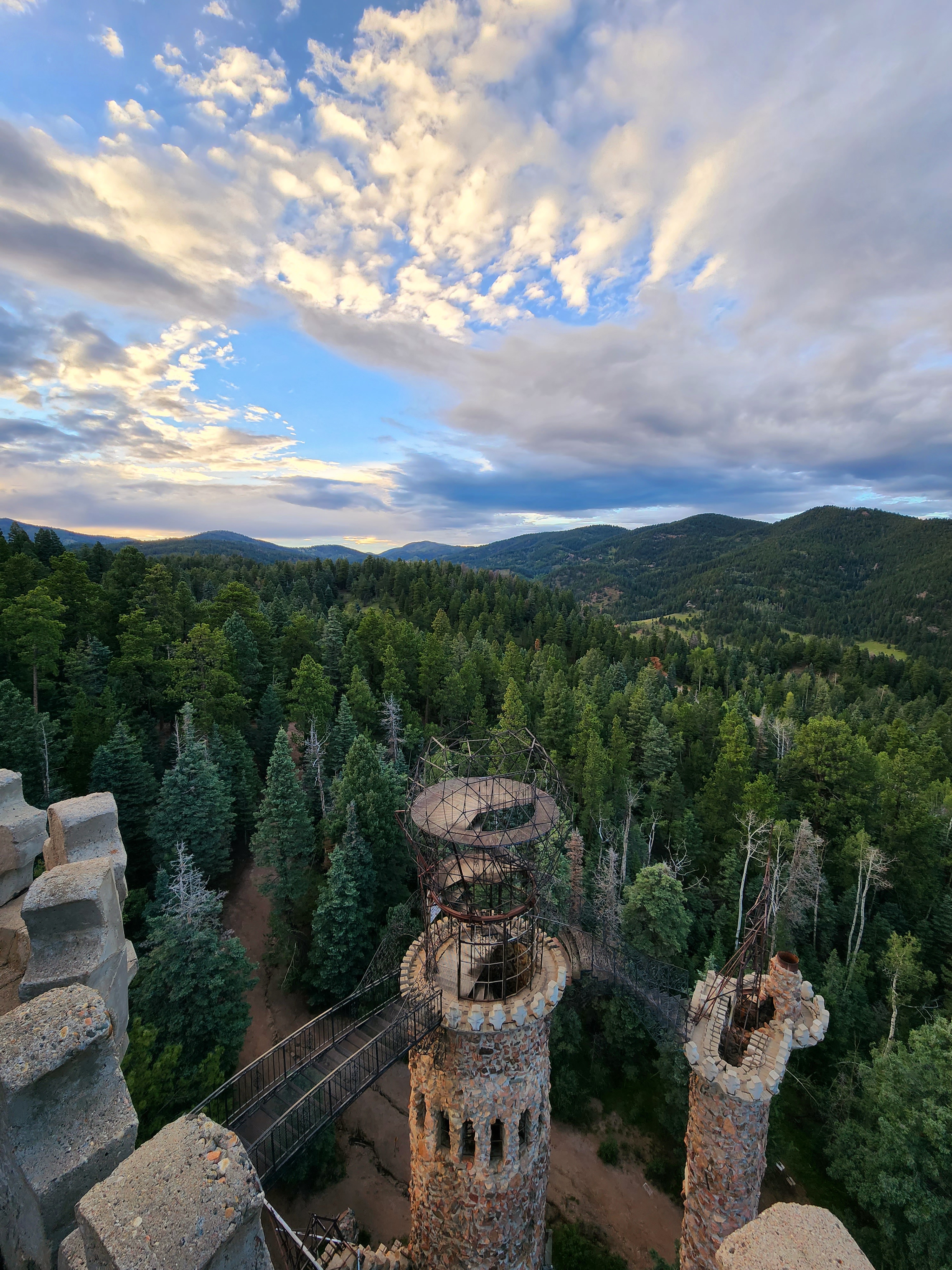
After the lake, we stopped by Bishop's Castle before they closed for the evening. 

This is a unique Colorado landmark that is still under construction.


***

Saturday, 8/27

Machine chest press.

Machine pull-downs.

An evening family walk at the Homestead Ranch Park, followed by a bit of stargazing. 


We saw a fearless porcupine right on the trail! I've never seen a porcupine in the wild before.

***

Sunday, 8/28

Lunges - with 15 lb dumbbells.

***

Monday, 8/29

Yoga swing pull-ups with rotation.

Planks.

An afternoon drive through the Colorado countryside.


***

Tuesday, 8/30

Rest.

***

This last week was a little light on running, with a little more strength work. I wish I could do more of both!

But we did have a ton of family adventuring this week. There's so much to see, so that was really lovely. 

Goals for the upcoming week include getting a long run in (hopefully marathon-plus), and maybe doing some heavy barbell deadlifts (not on the same day!)

Monday, August 22, 2022

Week of August 15th through August 21st, 2022 - Florissant Fossil Beds; Garden of the Gods

Monday, August 15th:

Lying leg raises (straight-legged). I need do more core work. This was just a small start.

I made our usual pizzas from scratch for dinner. I've refined the recipe over the last few years to the way we prefer - less greasy and more like a cheesy bread. I put parmesan cheese stars on top for fun, to see if they'd still look like stars when it came out of the oven. They kind of worked out!

***

Tuesday, August 16th:

8.5 miles in the rain. I was soaked by the end. Right about then, the rain stopped. Never fails! Nonetheless, this was a good run for me. The rain must have kept me cool, since my average pace was quite a bit faster than my usual for a run of the same length.

Later, I did a few lightweight side lateral raises and front raises.

***

Friday, August 19th:

With the exception of a daily walk with my family, I took three days off from exercise. Although not totally planned, (I have just been too busy!) it was still nice rest my body a little. I did want to bank some energy for a long one tomorrow.

For Friday's walk, we checked out the Hornbek Homestead in Florissant (it is part of the Florissant Fossil Beds National Monument).

We got up there early to catch the sunrise and see if we could spot any of the Perseid meteor shower. (Although the Perseids are nearing their end for this year, I still spotted at least a half-dozen in the clear pre-dawn sky).

It was great to watch the twilight dawning in the east, and then we enjoyed our hike through the meadow in the morning dew.


All the recent moisture has made early mornings in the mountains unseasonably fresh, cool, and almost spring-like.

***

Saturday, August 20th:

I set out early this morning for a long in-town loop.

Initially I had planned to go to the mountains today, but Alex was hesitant because of early thunderstorms that were anticipated. I reluctantly agreed that he was correct, the high risk of storms meant the mountains would be safer on another day.

I opted to do a big loop through the Garden of the Gods. There's plenty of natural beauty right here in town, too!

I ran from the Rock Island Trail to Monument Valley Park, connecting to Sondermann Park.

The sunrise was beautiful in Mesa Open Space as I made my way over to the west side, by crossing Mesa Road and passing through Pioneer Park.

Top, Middle: Sunrise from Mesa Open Space. Bottom: The "Tolerance Trail" is a short-cut to Pioneer Park and the west side of Colorado Springs. 

I entered the Garden on Ridge Road and linked into the Old Colorado City Trail, which brought me directly into the very south end of the park.

The views along the red rock ridgeline were grand! I could see everything to the south, including all the formations of Red Rock Canyon.

It's been a while since I've entered the Garden on this particular trail, and I forgot what a gem it is.

Entering Garden of the Gods on the Old Colorado City Trail. 

On a prominent ridge, I took a mid-run break, about 10 miles in. I sat and took in the view of the mountains, watching distant clouds pass around the summit of Mt. Garfield.

All of the clouds were swirling around above 10,000 feet, so I was glad I didn't go up there today. Still, the view of the lower mountains from here was great.

I took out my mini binocs and checked out the Incline. I used to sit in this area and spot individual people on the Incline, the summer when I worked in the Garden. But my mini binocs aren't as powerful as the big ones I had with me during park safety duty.

Just as I looked at the Incline, a person in a white shirt appeared. I silently cheered him (or her) on. Go white shirt person! Thanks for wearing a white shirt which made you easy to spot!

After a rest, I decided to connect the Old Colorado City Trail to the Buckskin Charlie. This lovely trail was fresh and cool. I wound around many curves on this dirt path and eventually joined the Scotsman Loop.

Buckskin Charlie and Scotsman.

Scotsman Trail brought me right to the south end of the Central Garden.

A digitally generated "painting" of my photo, on the Scotsman Trail approaching the Central Garden. 


From here, I decided to hop onto the Palmer Trail, sticking to the theme of dirt trails in the Garden. Palmer Trail circles the northwest side of the park, and connects to the Dakota Trail. I then exited the very north side of the Garden and joined the Foothills Trail for my run towards home.

Top: Views from Palmer Trail. Bottom: A peek into lower Queens Canyon from the Foothills Trail.

All along the Foothills Trail, Sinton Trail, and Templeton Gap Trail on my way home, the wildflowers were popping!

All the recent moisture has enlivened the flowers. I couldn't stop taking photos!


My favorite wildflower photo of the day was actually a thistle flower. It was so colorful and symmetrical, it really caught my eye.


Around 14 or 15 miles in, I started to feel like my feet were very heavy and like I was dragging.

Somehow, even with all the rest days prior to this run, I still felt tired. But I was mentally in a good place, so I just resolved to go slowly and keep moving.

I've had runs where I was so tired that I just wanted to be done already. But over the years I've realized that embracing the moment is even more crucial when tired. If you're a runner, you're going to have days where you feel heavy, whether it's expected or not. You'll have to keep dragging on tired feet regardless. Focusing on the moment and enjoying your surroundings is just much more pleasant than wishing for a run to be over. 

This run ended up being a better mental exercise than physical exercise for me, since I was able to maintain a positive mindset the whole way, even though I wished my pace had been better.

When I neared Union on the Templeton Gap Trail, I decided to add one more park to my day. I connected from the trail into the west side of Palmer Park, climbing directly to the small overlook along Palmer Point.


As soon as I got onto the dirt trail in Palmer, I realized this was going to be a sloppy, slow mile. The trails all throughout the Garden had been solid - the rainwater had been soaked up by the red sand and made a packed surface that was solid - not muddy at all. However, in Palmer Park, the rain had saturated the trails so much that the silt had become clay. It was thick, sticky mud that accumulated on your feet.

I laughed that my last few miles would slow my average pace down even more. But I enjoyed the trail and the fresh mist in the air that wasn't quite rain yet.

Finally, I made it home. My total for the day was 21 miles! This loop was another great one, filled with so much beauty in our local Colorado Springs city parks. What an unbeatable place to live!


***

Sunday, August 21st:

We enjoyed our hike in Florissant so much that we decided to get up early and head up there again. We left early enough to look for meteors again, but just as we arrived, the clear skies clouded over within minutes.

No matter, as the sun came up, another gorgeous Colorado dawn greeted us.

This time, we walked on the Shootin' Star Trail.


As we headed back towards town, the back side of Pikes Peak had a huge thunderhead forming above.

Then, in the afternoon, Alex got us a fancy takeout lunch from Red Lobster in celebration of our wedding anniversary. πŸ’‘ We went on a drive out east and sat on the plains, eating and watching the clouds pass by on the other side of the mountains.

Top: The back side of Pikes Peak, near Divide. Bottom: The same clouds as viewed from the eastern plains, near Calhan.

It was a reflective and peaceful day 😌. 

Later on, I did some dumbbell press-outs and lightweight squats, just to keep a bit of strength training in the mix.

***

Wow, that was a long post for a regular weekly update. It was really a lovely week!