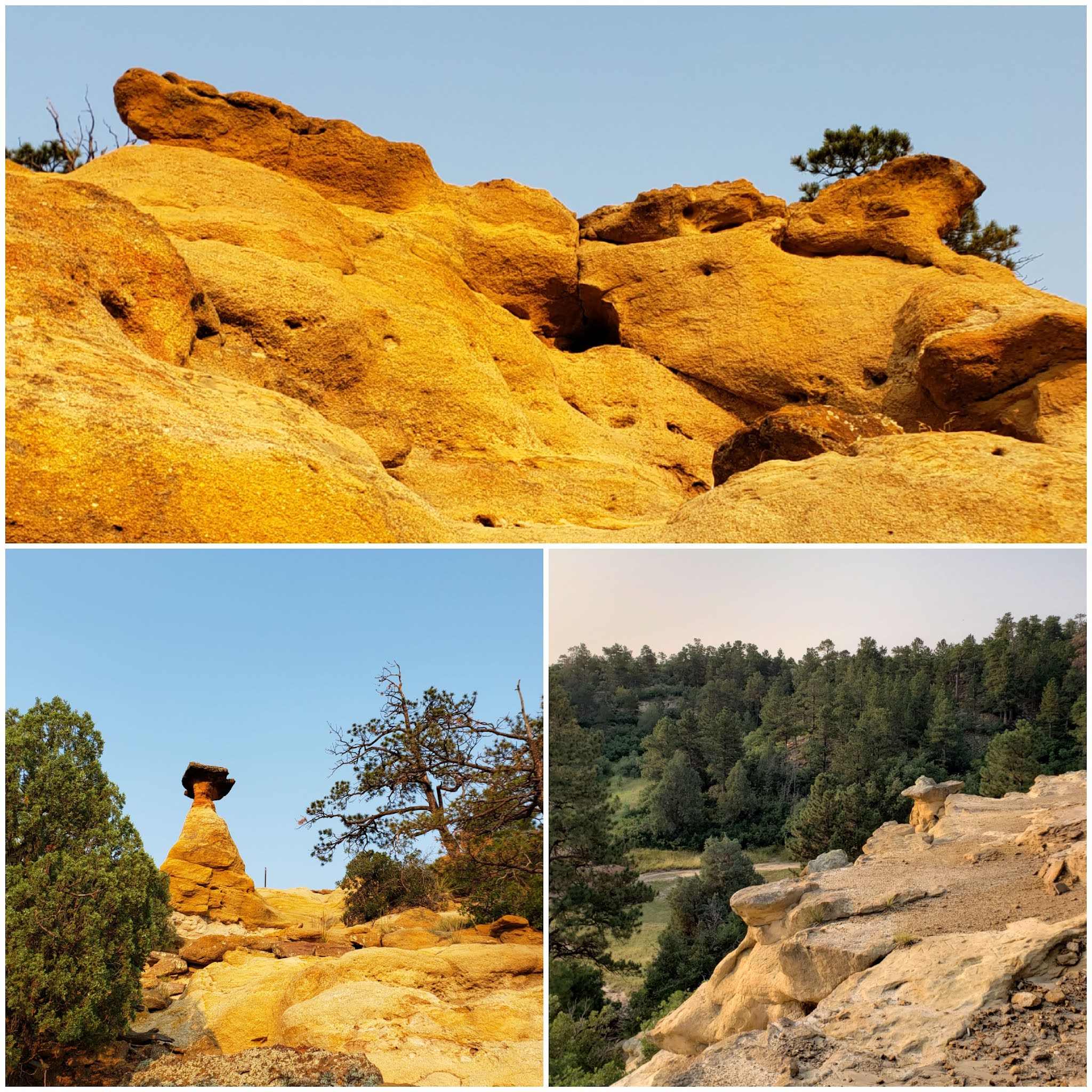
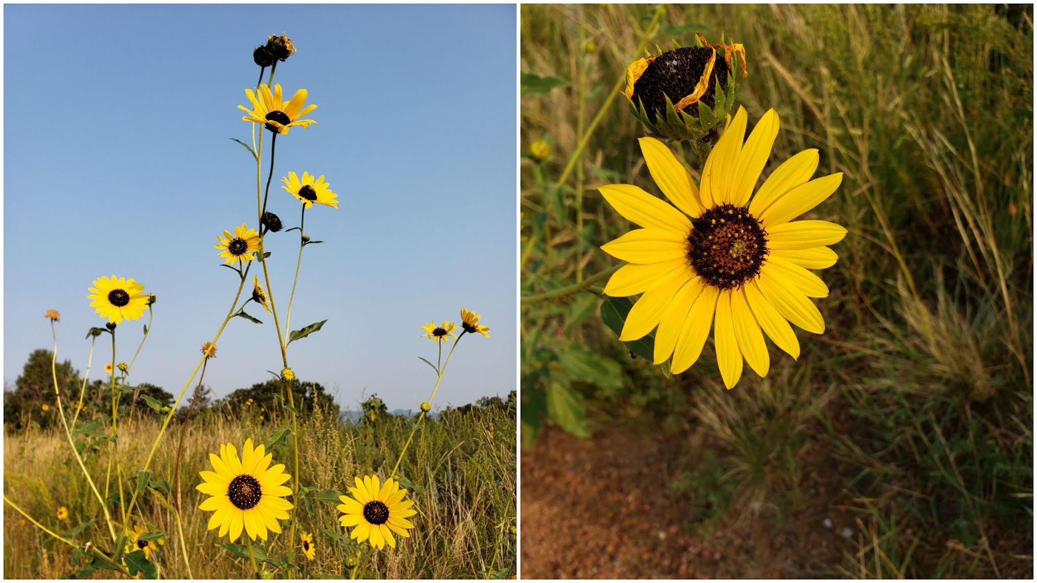
Friday, August 27, 2021

Lory State Park, Twin Eagles Trailhead, Elevenmile Reservoir, & Almagre North from the Northern Ridgeline

I got to go to the real mountains, on a real mountain adventure! It even included the kind of rock-hopping, scree-climbing, grabbing-the-dirt, route-finding fun that I have been longing for.

But more on that in a minute! First, I wanted to review the last few days which have been fairly adventure-full as well.

***

Saturday, August 21st, 2021:

This day was mine and Alex's anniversary, and we went to Lory State Park for the first time. We hiked up a trail that went along one of the hogback uplifts that are characteristic of the area, and got an amazing overview of Horsetooth Reservoir. 

A view from the first part of the trail, looking west towards the western part of Lory State Park.

The lovely trail we ascended, looking back through late-summer meadows.

At the top of the trail we took, there was a magnificent overlook of Horsetooth Reservoir, complete with small boats way down there!

***

Sunday, August 22nd, 2021:

Today we took the kids out for a short walk and a splash in Tarryall Creek, up at the Twin Eagles Trailhead in the Lost Creek Wilderness. 

A short hike from the trailhead brought us to the stream and a cold-water swim for the kids.

Near the Twin Eagles Trailhead.

Swimming in Tarryall Creek.


***

Tuesday, August 24th, 2021:

Today we headed out later in the afternoon and drove up to Elevenmile Reservoir. It was a lovely day. We took a stop at Wilkerson Pass and peered at the distant fourteeners. Then, we went for a walk down around the lake. Alex tried to catch a fish 🐟 and the kids got in the water by the shore for a bit.


Lovely clear water and a golden sunset at Elevenmile Reservoir. 

Before going back home, we found a dark spot and watched the twilight fading and the milky way appearing. It was so beautiful to see the full starlit sky, far enough away from the city lights.

***

Wednesday, August 25th, 2021:

Finally, after what felt like a month of wildfire smoke blanketing the state, I was able to go back to the mountains for a true adventure.

My decision for the day was to summit Almagre North. Partly, I decided to do this because, while I've stood atop the summit of Almagre South, I actually barely skipped the true summit of Almagre North during my last time up here in summer 2019.

I would approach it from the north, near the South Slopes Rec Area, and then descend to the south, making a big loop.

I started from the top of North Cheyenne Cañon, going up Seven Bridges (trail 622) until the junction with 667.

Moonset on trail 622, and aspens near the junction with trail 667.

The sun was brightly shining as the moon set. The aspens are lovely and green.

I continued up trail 667 for a ways, until I reached the bridge over the South Ruxton Creek drainage, directly to the north of Almagre, and fairly near to the long northern ridgeline of the mountain.

Here I began following the drainage to the south and steeply uphill. Soon, I encountered what I believe was some cabin ruins near the green, flowing creek. 

What I presume are the ruins of an old cabin chimney, next to the flowing South Ruxton Creek. 


A friendly little picturesque mushroom 🍄. 

I continued following the drainage until I soon broke out into a huge, steep scree field.

I saw the ridgeline to the west, but decided to just outright climb up the scree field before joining the ridge. I actually like the feeling of scree climbing, clambering up a slope on all fours in the dirt. It's a great feeling to be on such a steep slope with an open view in all directions.

I kept climbing up, grabbing at rocks and scree to keep from sliding too far back with each step. At one point, I accidentally grabbed a small high-alpine shrub, and suddenly a perfume-like scent wafted up at me. I investigated more carefully, and grabbed the shrub again, intentionally this time. A fresh, strong scent of orange peels mixed with anise filled the air. Amazing! The terpenes in this plant were overpowering. I couldn't get enough. Additionally, this plant looked so interesting that the photo just doesn't do it justice. It looked so waxy on the outer leaves that it almost looked like a fake plastic terrarium plant. 

Top left: a small high-altitude shrub that smelled like orange peels and anise. Top right: the view up the scree field that I climbed. Bottom left: the view back down into the basin. Bottom right: small alpine flower.

I'm always amazed by the alpine tundra and the flora that survive there in such a harsh environment. I think I see something new, some new plant or flower, each time I go.

I kept scrambling up the scree slope and eventually trended to the west a little, coming to the join the ridgeline. This part was an easy class 3-ish scramble up jagged boulders. Route-finding was fairly simple, and the rock outcroppings were awesome to behold.

A really neat rock along the northern ridgeline of Almagre, with Pikes Peak in the background. 

Upper right: part of the ridgeline scramble. Bottom: view down to Lake Moraine. 

Some of the views along the ridgeline. 

Some more of the amazing flora that inhabit the alpine tundra.

I was having a great time scrambling up and over rocks, route-finding and taking in all the views, when soon the ridgeline broke out into a huge alpine meadow of golden yellow grasses.

Panorama from the alpine meadow just below Almagre North's summit.

At this point I could see the Almagre North summit and knew I was within a few meters of the top. I quickly ascended the last few steps and sat atop to soak in the views for a short time.

Almagre North summit views. I especially enjoy the bottom photo, which is the view down into the Pikes Peak South Slopes Rec Area.

I began making my way down the service road from the top, continuing in a southern direction. From here on, the remainder of my day would be straightforward, going downhill on the service road 379A to 379, then connecting to trail 701 at Frosty's Park, which leads to trail 668 (Pipeline trail), and finally rejoining trail 622 to close the loop.

But before I could get to all that, I wanted to play around in the alpine tundra for a while.

One of the reasons I love Almagre mountain so much is because of the huge variety of rock outcroppings that cover its wide upper slopes. I could probably stay up here for hours and climb various rocks, getting new and unique views from atop each one.

But I decided to settle on one particular rock that I had skipped on climbing last time I was up here due to lack of time.

More alpine flowers and views, including the (bottom-left) view down into the sunny Almagre Reservoir basin.

Top: the outcropping I decided to scramble up. Bottom: the view down from it.

I sat atop the rock, feeling like the king of the mountain. But within a few short minutes, a bitterly cold wind began to blow, reminding me that I was but a visitor to this unique landscape, and my time was almost up.

Top right: stream and boggy land in the Almagre Reservoir area. Bottom left: Almagre dam.

I continued my descent down the road, admiring the views to the east of Colorado Springs and Mount Rosa with her wide, sandy northern saddle.

Colorado Springs down below Mount Rosa's massive slopes.

The mountain thistles along the road 379A were gigantic. They had huge hairy heads with multiple "eyes" that attracted all kinds of bugs, including cool-looking iridescent blue bees.

Top: wooly mountain thistles, standing between 3 and 4 feet tall. Bottom: the pretty little marsh near the junction of FS 379A and FS 379.

I summoned the energy to begin jogging downhill. The evidence of the wet spring and early summer is still abundant, with green streambeds and bright wildflowers still coloring the hillsides.


I finally crossed all Seven Bridges, finishing my adventure the way it had started.

Wow! What a day! I had experienced so much nature packed into one day. A challenging uphill climb along the northern ridge of Almagre, unique aromatic plants, rock-hopping in the alpine tundra...

And I'd ended up with almost 22 miles total with nearly 6000 feet elevation gain. I'd call that a good one!


Thanks for following along! As autumn quickly approaches, I hope to experience more of my favorite season in the mountains. 

Thursday, August 19, 2021

Bluff-hopping through central Colorado Springs

If you look at a 3D map of Colorado Springs, you will notice a huge area of uplift that runs like a big diagonal through the heart of town, southeast to northwest. Starting from the southeastern corner of Palmer Park, these bluffs form an essentially continuous rise through Palmer Park, Austin Bluffs Open Space, Pulpit Rock Park, and Ute Valley Park, all the way until they run into the foothills.

They rise up and down many times, creating peaks and valleys. Like a giant put his hand down from heaven, we mere mortals are left on the ground to scale each finger individually.

That's how I ran 13 miles this morning, with almost 2000 feet elevation gain, right in the heart of town.

I started out by ascending Edna Mae Nature Trail Palmer Park, coming up to the top of the first mesa I'd cross. I descended the Yucca trail into Lazyland and then encircled the northern side of the park, westbound. I went through the pedestrian underpass at Austin Bluffs & Union, beginning my ascent of the UCCS bluffs after a short uphill jog through the eastern part of the campus. 

Soon, twilight began to illuminate my climb near the top of the UCCS bluffs.


I topped out the UCCS bluffs, crossed the street,, and immediately entered into Austin Bluffs Open Space on a new trail that I'd never been on before. The trail climbed gently along a prominent ridgeline until an open view of Pikes Peak popped out right in front of me!

I was amazed that I've been living so close to this gorgeous trail for so many years and didn't even know it existed. How awesome!!

After a short yet steep descent from this bluff, I entered one of the pretty meadows with the sunrise beginning to illuminate the fields.


The grasses in the meadows were beginning to get a little bit golden, and there was a distinct chill in the morning air that indicated it was already mid-August, well beyond the peak of summer.

The sun took a long time to actually peek above the horizon, and the morning twilight seemed to last forever. More indications of the rapid approach of autumn!


Around every new bend in the trail was more unique rock formations. Many of these formations are ones I've seen in photos, without knowing the exact location of them in the real world. That is, until now!


The sunrise and the photogenic clouds just got better and better as I continued on this fascinating trail loop.


Austin Bluffs Open Space truly is a hidden gem. I was a little hesitant about even posting this blog (it's too good of a find to give away!) But then I realized that very few people read my blog, anyway. :)

After I completed my journey through Austin Bluffs Open Space, I descended through University Heights and crossed over Union, coming to the north side of Union Meadows Open Space. This small open space is still blossoming with late-summer colors.


As I continued my southbound trek, I returned to Palmer Park's northwest corner, and decided to complete my adventure for the day by returning along the Palmer Point trail, which hugs the western border of the park.

By this time, the sun was brightly lighting the hillsides in the foreground and the mountains behind. Wispy patterns high in the sky made for a very picturesque view to the west on this clear day. (So glad the smoke from the fires isn't here at least for today.)


As I finally returned home and got a chance to soak in all I'd just seen, I realized how much beauty there is to appreciate so close to me.

I'm thankful I found this particular trail loop, which is close, convenient, and will make a good winter training loop that won't require a trip to the mountains.

Of course, I'm still looking forward to some mountain adventures this late-summer and autumn as well. I am just biding my time and waiting for completely smoke-free days to return to the Front Range!

Monday, August 16, 2021

A photographic journey of the last week (Palmer Park and Pueblo Reservoir)

Beginning last Saturday, August 7th, the air quality has been mostly bad in Colorado Springs. I've fit in a few outdoors workouts in the good air quality times, with at-home workouts when the air was the worst.

It makes me sad to think that this is the way summers in the West are now. I used to love the peak of summer, now it's just filled with smoke.

I wanted to share some photos from the last two days, and summarize what I've been doing in my training lately.

***

Saturday, August 7th, 2021:

When I heard the smoke would be pouring in to the Front Range, I got out early on August 7th and did 10 miles with 800 ft elevation, prepping myself for more time indoors for the following week.

***

Monday, August 9th, 2021:

1 hour on the exercise bike - 30 mins casual pace, followed by a 30 min training video with 8 x 30 second all-out sprint efforts.

***

Wednesday, August 11th, 2021:

Comprehensive upper body workout with machine butterflies, pushups, dips, and supplemental support exercises (side lateral raises, etc.)

***

Thursday, August 12th, 2021:

1 hour 30 mins exercise bike. I can watch dirt bike GoPro videos and pretend I'm riding on hills in the Rampart Range instead of sitting in my living room. 😆

***

Friday, August 13th, 2021:

Finally a cold front pushing through began to clear the air. I got outside to do 9 miles with 800 ft elevation. 

***

Saturday, August 14th, 2021:

7 miles, mostly flat. A quick, cool early morning jog.

***

Sunday, August 15th, 2021:

9 miles with 900 feet elevation gain in Palmer Park in the early morning. I looped the park clockwise. The sun is rising later already, signaling the gradual coming of autumn.

Top: morning twilight breaking in the east.

Clouds before sunrise near the southeast side of the park. 

Then, on Sunday evening, I did a walk at the Pueblo Reservoir with the family. The weather was cool and fresh, not hot like you'd expect on an August evening in Pueblo. 


Sunset with distant rain clouds.

***

Monday, August 17th, 2021:

The air was already noticeably hazy at sunrise, but clear enough for one last run. I could still see Pikes Peak clearly enough in the distance. As the morning would go on, the smoke would continue to pour in.

I made it my mission to get some scrambling in. I would end up with just a little less than 8 miles and a little more than 1000 feet elevation. 

Scrambling up the bluffs in Palmer Park is always a good time. The bluffs are gentle and mostly forgiving for route-finding practice. Today, I started out by scrambling the south-central cliffs of the northern mesa.

A slightly hazy start to the day, with Pikes Peak off in the distance and a red sunrise over the little cave. 

I looped around the northern mesa of the park counter-clockwise today, descending into Lazyland and then climbing back up, this time on the north-central bluffs.


Classic formations towering above Lazyland. 

Finally, I completed my counter-clockwise loop of the park by rounding the bend at Yucca Flats and descending once more, this time down to the Palmer Point trail.


Happy flowers on top of the northern mesa (Yucca Flats.)

Palmer Park is great trail-climbing practice if you know what you're looking for! It's such a fun park, a real gem for locals, especially once you get used to the winding, confusing nature of the trails. The trick to Palmer Park is not worrying about exactly where you are on the trail at any given moment, but rather retaining a generalized sense of direction, since most trails twist and turn quite often.

For now, I'm relegated back to the indoor bike trainer and weights until the air quality improves. I'm hoping that once it does, I'll be able to do some real big climbing in the mountains ⛰.

Monday, July 26, 2021

A week of wandering: Pineries Open Space, Temple Canyon Park, Austin Bluffs Open Space & more

 ***

Monday, July 19th, 2021:

This day, I did a late-morning loop through Palmer Park, hitting Palmer Point first before encircling the park clockwise, descending the far eastern bluffs and ascending once again through Council Grounds. I hit up Grandview Overlook before descending the road.

Bluffs above Council Grounds. They provided a nice short class 3-ish scramble. 

I got about 8.5 miles and 1000 feet of climbing. 

***

Tuesday, July 20th, 2021:

I did an hour on the exercise bike at a very casual/ non-athletic pace. My primary goal was recovery and just getting myself moving, not a "workout." And in the evening, I did barbell deadlifts (7 sets x 10 reps) and machine butterfly. 

I haven't worked out in the gym in quite some time. I've been occupying my exercise time lately with mostly very long mileage. In the peak time of summer, sometimes my lifting falls by the wayside a little because I *enjoy* doing the extra mileage while I can. In the winter, sometimes it's easier to do more gym work when the weather is better for indoor exercise. 

In any case, my lack of weightlifting lately meant that these deadlifts absolutely destroyed me, although mainly in my lower lats as well as my upper glutes.

***

Wednesday, July 21st, 2021:

I ran a 15-mile loop in the late evening, a standard loop that I've done many a time throughout the years. About halfway through the loop, I pass by the Garden of the Gods overlook along the Palmer-Mesa trail. 


The sun had already set by the time I reached the overlook, but the Kissing Camels were nicely lit up.

I'm surprised I survived this loop and actually at a fairly fast pace, despite being still very sore from my deadlifts the day before. 15 miles and 1100 feet elevation gain.

***

Thursday, July 22nd, 2021:

We decided to check out the Pineries Open Space, a new open space in Black Forest. We ended up walking about 3 miles with the kids.


The whole trail is a 9 mile loop, even though we only did about a 1.5-mile out-and-back. It was really lovely and enjoyable to just walk with the family. The air was fresh and cool. This is definitely one I'd like to return to for a run.

At home, I did pushups with rotation (using the "perfect pushup" rotating handle grips.) These rotating pushups add a small extra element of challenge, and for me, help focus on weak(er) spots with the pushup. I got a bit sore from these in the forearms and triceps.

***

Friday, July 23rd, 2021:

We visited Temple Canyon Park near Cañon City for a hike with the family today. It was super hot when we first arrived. We climbed a sandstone canyon that was filled with fossils. What a neat and educational space to explore!


After we reached the top of the sandy canyon and walked a little further, a fast-moving storm began rolling in. We ran down the trail that went along the side of the canyon, hiding under some brush during the worst of the rain. This part of the desert is prone to flash flooding, so we didn't hide down in the wash, but avoided the hilltops for fear of lightning. We chose the middle ground in this situation (literally). But the storm only lasted a few minutes and we safely returned to our vehicle and headed home.

***

Saturday, July 24th, 2021:

I got up early and went on a sunrise 15-mile loop, a different one this time.

My loop took me through Austin Bluffs Open Space, next to Pulpit Rock Park. 


I have yet to actually climb Pulpit Rock itself. This cute little open space was just a nice small addition to my workout today, which ended up just over 15 miles and 1300 feet elevation gain.

***

Sunday, July 24th, 2021:

In the morning, I did an upper-body focused gym workout. I did a variety of chest presses at different angles on the workout machine in our garage, plus some shoulder exercises and dumbbell raises. My goal wasn't to make myself overly sore, but get a good all-around upper body workout in.

In the evening, we went out with the kids to run around on the plains a little and get some fresh air with appropriate social distancing. We spent some time at Kirk Hanna Park in Hanover.


It was super windy on the plains!!

***

That was a pretty full week!

Now that it's Monday again, I'll probably head out for a short evening run tonight, to get my week off on the right foot. Maybe I'll get back to the mountains sometime midweek for another long one! 

Sunday, July 18, 2021

Ridgeline Trail (Red Rocks Canyon) to Mt. Buckhorn at sunset

I ran 10+ miles at sunset on Saturday after the rain and thunderstorms passed through. It was a very brief patch of rain and did not bring much moisture through, but it still kept mostly everyone home. What a nice quiet night.

The trail was not muddy at all, nor had any puddles. But the small amount of rain that did pass through quenched the ground's thirst just enough that there was no dry, dusty trail, and the trails had improved traction. Perfect trail running conditions. 

I set out into Red Rocks Canyon from the new 26th street parking lot. The trail is a wide dirt road, first descending into the Hogback Valley and quickly climbing out into the southeast side of Red Rocks Canyon.

26th Street Connector to Hogback Valley. 

View from one of the hogback sandstone outcroppings.

Since I was already right along the ridge, I continued following the hogback sandstone ridgeline that trends generally south. (If you're interested in the geology of the region, I believe this hogback sandstone ridge continues north into the Garden of the Gods and becomes the Niobrara trail.)

This trail is aptly named the Ridgeline trail.


The sunset kept treating me to amazing views down into the canyon.


I don't think I've ever run the entire Ridgeline trail from Red Rocks Canyon to Section 16 before. I've run the upper connection, one valley over, which connects to Section 16 through the Intemann trail (past the intermittent waterfall trail). 

Because it's right up along the ridge, the views are persistent and amazing! What a great alternative trail along the eastern ridge of this amazing canyon.

Soon I could see the characteristic rock of Section 16 coming up.


At this point, the trail descends the ridge rather quickly and lands you right at the Section 16 parking lot. Then I went up the short section of road to connect with High Drive, which ascends Bear Creek Canyon. 

From here on, it was beginning to get dark, so I tried to limit my photos. I was also trying to get somewhat of a workout in, so now that the sun was mostly down, I tried to focus on climbing on the wide, steep High Drive. The air was so fresh and cool!! What a perfect evening. I love when I can truly smell all the trees as I climb up a canyon.

I took a photo just as civil twilight was ending, capturing Specimen Rock above the canyon in fading light.


I had a goal in mind, and I didn't want to give up before attaining it. I climbed up the rest of High Drive and turned onto the trail 667 west at the saddle. This segment of trail goes up Mt. Buckhorn.

Buckhorn is a short little worthwhile summit. Often overlooked, and only about a mile to the top from the saddle, the elevation gained does make it feel a little bit longer.

I had a cool view of the Colorado Springs city lights to the east. It was easy to make out landmarks even in the night, like the mountaintop lodge owned by the Broadmoor on top of the north side of Cheyenne Mountain, with the radio tower farm just to the south, and the backside of the Broadmoor Hotel proper down below.

Colorado Springs city lights below, to the east.

Once on top, I was treated to nighttime views of Cheyenne Cañon. 

The almost perfect half-moon shone brightly behind the clouds in the sky, bringing out the outlines of the more prominent mountains. The half-dome appearance of Cookstove Mountain was especially stunning in the moonlight.


I spent just a minute to soak in the nighttime view. I really wished I'd had more time at this point, to just hang out on the rock outcropping on top of Mt. Buckhorn and soak in the views of the canyon all night. I had had an amazing run, and I just wanted this moment on top to last forever. Maybe longer next time!

After a brief pause, I made my descent. The one mile off of 667 felt longer due to the steepness, but once I reached High Drive again, I was flying. I just enjoyed the rapid run down the smoothly graded dirt road (which isn't open to vehicles except maintenance.) When I reached the part where the road meets with Bear Creek Canyon trail and descends by the river, I was hit with the freshest air I'd encountered all night. It was like breathing a whole field of Christmas trees. So much pine!

I completed my run by coming out of the canyon and running down 26th street towards the Bear Creek Nature Center.

A little over 10.5 miles, perfect for a sunset run! I was so happy to be able to turn this short run into an adventure. I felt like it gave me a lot of bang for my buck, a lot of fulfillment for a short(er) trip. I got a great sunset view over Red Rocks, a ridgeline traverse, a small but beautiful summit with a decent amount of climbing, and a big dose of fresh pine-scented, stream-cooled air.

I'm thankful that I got to do this one, even if it wasn't a huge mountain loop like usual. It's peaceful to find joy in the ordinary, close trails.  👣 

Friday, July 9, 2021

Monument run & mid-year update

Hello and happy Friday!

Yesterday, I did a long run to Monument, 19.4 miles. One week after doing 30 miles, and feeling decently solid 💪 especially considering the extreme heat (more on that in a minute!)

First of all, a general update: 

Halfway through the year, my total mileage exceeded 850 miles, so I'm still on target to reach my goal for the year of 1700.

I've been slowly dropping the excess body fat weight that many people have experienced during the pandemic. I have been keeping up with weightlifting a couple times a week, which isn't a whole ton of lifting, but it is enough for me at the moment. I feel that I've reached a good balance where I'm not losing a lot of muscle even as I'm slowly dropping a few pounds. I'm at a pretty good place right now, but still around 23 BMI. Distance runners may benefit from maintaining a BMI closer to the low end of the healthy range, like 19-20.

Last week, I took a short walk at Rhyolite Park in Castle Rock with the family. It was quite a pretty park to check out, with views from the top that displayed most of the whole Front Range. Great views all the way from Longs Peak, to the Indian Peaks, to the Lost Creek Wilderness, to the Rampart Range, and south to Pikes Peak. I didn't get a decent panoramic photo, so I'll have to return for that.


***

Now on the main story!

I took off yesterday at 7 am sharp, which was way too late. I had planned to go earlier, but just had a busy morning and didn't get going until later than I wanted.

I ran to the Templeton Gap trail, following the spillway northwest to Nevada Ave, where I ran north for a long block and joined the Pikes Peak Greenway at Austin Bluffs.

From there on, it was a straightforward route north along the trail. But it began to get hot very rapidly.

I had about 3 liters of fluids with me (2 L water and 1 L Gatorade with some extra electrolyte salt.) I had planned on doing 20 miles today, and I'm glad I didn't have my heart set on a more ambitious goal, because I knew my fluids wouldn't last much longer. On a cooler day, I can get away with about 1 liter per 10 miles for long runs. (Many runners can get away with much less, but I like to stay fairly hydrated.)

The view from the meadow on the Air Force Academy just after the trail entrance was very pretty. Many wildflowers are still in full bloom.

The open field just after the AFA entrance on the trail.

Around mile 12, the heat began to really get to me. I stopped in the shade for a few minutes, drank some extra water, and had a snack. I was 90% ready to give up, but somehow the 10% of not quitting won out. 😅 My phone said the temperature was 90 degrees, but the heat bouncing off the trail felt hotter than that. Furthermore, I knew the next stretch had some pretty extreme exposure, especially once I reached the long flat stretch before N. Gate Blvd. 

My pace was falling due to the heat, but I pressed on at a slow jog, since walking felt worse.

I got a panoramic shot of the field near N. Gate Blvd and some pretty white thistle flowers.


Panorama of the field before N. Gate Blvd along the New Santa Fe Trail on the AFA. 

In order to manage the heat, I took a few more brief stops in the shade along the way, pressing through the exposed areas as well as I could.

I was thinking about all the ultramarathon races that take place with exteme heat conditions, like Moab or Cocodona. If those competitors can tolerate mile after mile of extreme heat and exposure, I could handle another 7 miles or so!

I managed to get to my end goal of Monument with 19.4 miles total, and about 1600 feet elevation gain. I've previously run this route and it was "about" 20 miles, but I must have shortcut it a little today, which was OK with me. I'm counting this one as making my goal for the day! I was so happy to have gotten it done, even if my pace was slower due to the heat.

Now that I had a full night's rest, I feel very recovered and honestly not like I even ran yesterday, which is a little bit bewildering.

Today's goal is a moderate weight session, followed by a run tomorrow morning of 8 to 10 miles. Ultimately, I'll try to get to the mountains sometime next week for a real adventure, but we will see!!